Bear Lake – The Caribbean of the Rockies,
Mapped for You
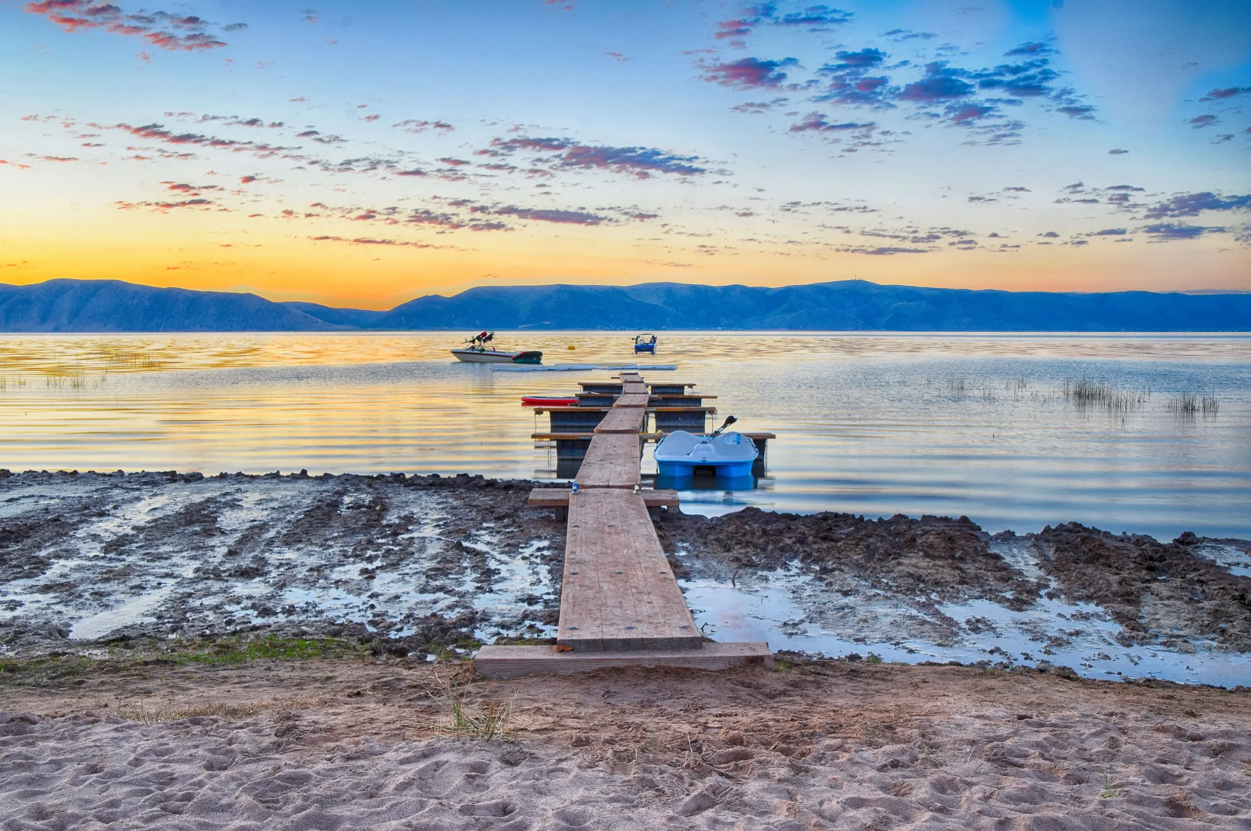
Bear Lake sits on the Utah-Idaho border, famous for its stunning turquoise water and family-friendly shores. Whether you’re camping for the weekend, towing the boat up for a summer day trip, or planning your first visit, Bear Lake is one of those places that keeps families coming back year after year.
Lake Genius maps Bear Lake with 400+ curated points of interest, daily water level tracking, underwater terrain data, offline maps, and trip planning tools – so you can spend your time enjoying the lake instead of figuring it out.


Start your free trial · No credit card · Works offline
Why Bear Lake Boaters Love Lake Genius
Find the Spots the Locals Know
Bear Lake regulars have their go-to beaches, fishing holes, and camping spots dialed in. If you’re visiting for the first time – or only make it up once or twice a year – it can feel like everyone else knows something you don’t. Lake Genius maps 400+ curated points of interest across Bear Lake, including beaches, boat ramps, camping areas, fishing spots, and local favorites – so you can show up knowing exactly where to go.
Plan Before You Pack
Bear Lake is a road trip for most visitors – families driving from the Wasatch Front, Cache Valley, or southern Idaho. Lake Genius lets you explore the entire lake from home, mark your planned stops, and save routes so you’re not wasting daylight figuring things out at the ramp.
Water Levels and Underwater Conditions
Bear Lake’s water level does fluctuate, and those changes affect where you can safely navigate, which boat ramps are accessible, and where shallow areas may surprise you. Lake Genius tracks water levels daily and the X-Ray View shows you what’s beneath the surface, updated every day.
Works When You’re Off the Grid
Cell coverage around Bear Lake can be spotty, especially on the Idaho side and along less-developed stretches of shoreline. Download your maps before the trip and every core feature works offline.
Water Levels & Depth
Bear Lake’s water level can change enough from season to season to affect boat ramp accessibility and shallow-water navigation. Lake Genius tracks the level daily so you know what to expect before you make the drive.
Open the app and tap the Water Level button to see the current reading in feet or meters. The shoreline is highlighted in red on your map, and the X-Ray View shows underwater terrain contours so you can see what’s below the surface at any point on the lake.
UNDERWATER TERRAIN
See What’s Below the Surface
Bear Lake may be known for its turquoise water, but that beautiful color doesn’t show you what’s underneath. The X-Ray View in Lake Genius gives you a simulated look at the underwater terrain – as you zoom in, the app reveals 3D terrain contours and highlights hazards within 9 feet of the surface.
The data updates daily, so you’re always seeing current conditions. It’s especially helpful for navigating shallower areas near shore, around boat ramps, and in areas where the lake bottom rises unexpectedly.
Beaches, Camping & Fishing Spots
Bear Lake is a family lake. Sandy beaches, clear water, easy camping, and great fishing are what bring people back every summer. Lake Genius maps it all – 400+ curated points of interest covering beaches, public and private campgrounds, boat ramps, fishing spots, swimming areas, picnic sites, and local services.
The points of interest in Lake Genius are placed and maintained by the team – not crowdsourced from random user submissions. That means the markers you see have been verified, and they’re updated annually to stay current.
Whether you’re looking for a quiet stretch of beach, a campsite near the water, or the fishing spot your neighbor keeps bragging about, the app helps you find it and save it for next time.
Marinas & Boat Ramps
Bear Lake has several marinas and public boat ramps on both the Utah and Idaho sides. Lake Genius maps each one so you can find the closest launch point, check what services are available, and plan your route from the ramp.
Bear Lake State Park (Utah Side)
The main Utah-side access point for Bear Lake, with boat ramps, day-use areas, and camping. Bear Lake State Park is the most popular launch spot for families coming up from the Wasatch Front.
Bear Lake State Park (Idaho Side)
The Idaho side of Bear Lake State Park offers additional boat ramps and camping, with a generally quieter feel than the Utah side. A great option for visitors coming from Pocatello, Idaho Falls, or further north.
Bear Lake Marina (Cisco Beach / Garden City)
Located near the heart of Garden City, Bear Lake Marina provides slip rentals, boat rentals, and lake access in the most commercially active area on the lake. It’s the go-to for visitors staying at nearby lodges or rentals.
Plan Your Bear Lake Trip From Home
Bear Lake is a road trip for most visitors. Whether you’re driving up from Logan, Ogden, or coming over from Idaho, you want your time on the water to count – not get burned figuring things out once you arrive.
Lake Genius lets you explore Bear Lake from your couch. Browse beaches, camping, fishing spots, and boat ramps before you leave. Mark your planned stops, estimate distance and travel time on the water, and save your route so it’s ready the moment you launch.
When you’re on the lake, GPS tracking records your actual route so you can retrace the good days and share favorite spots with friends.
Bear Lake Weather
Lake Powell stretches across open water where storms can build and move fast. Wind, rain, and lightning can turn a perfect day dangerous in minutes – especMountain weather around Bear Lake can change quickly, especially in the afternoon during summer. Lake Genius gives you one-tap access to NOAA weather data for your exact location on the lake. Check wind, temperature, and precipitation before you head out, and keep checking throughout the day.ially in the wider stretches of the lake away from canyon shelter.
Lake Genius gives you one-tap access to NOAA weather data for any point on Lake Powell. Tap your current location or any spot on the map to see current conditions, wind speed, temperature, and precipitation forecasts. Use it to decide whether to head out, when to come in, or which part of the lake offers better conditions today. Weather checks in Lake Genius do require cellular service.
Works Offline
Cell coverage around Bear Lake can be unreliable, especially on the Idaho side and along less-developed stretches of shoreline. Download your Bear Lake maps before the trip and every core feature works without a connection – the X-Ray View, points of interest, GPS tracking, and saved routes all work offline.
Weather and water level updates require internet when you access them, so check those before you launch or while you have signal.
TESTIMONIALS
What Bear Lake Visitors Are Saying
TESTIMONIAL PLACEHOLDER #1
A testimonial about the overall app experience — ideally from a boater who used multiple features on a single trip. Example: someone who planned from home, used the X-Ray View on the water, and found a hidden cove via POI. Should convey “this app changed how I experience the lake.”
— John
- Bear Lake
TESTIMONIAL PLACEHOLDER #1
A testimonial focused on hazard avoidance or money saved — someone who spotted a hazard before it became a problem. Connects to the X-Ray View and water levels features. Should convey “this paid for itself immediately.”
— Steve
- Bear Lake
TESTIMONIAL PLACEHOLDER #1
A testimonial about offline reliability or trip planning from home — especially relevant for families or houseboat renters. Should convey “I was confident even in areas with no cell service” or “we planned the whole trip before we left.”
— Gabrielle
- Lake Powell
Frequently Asked Questions
What app should I use at Bear Lake?
What app should I use at Bear Lake?
Lake Genius is the boating app built specifically for Bear Lake. It includes daily water level tracking, underwater terrain data (the X-Ray View), 400+ curated points of interest, GPS navigation, trip planning from home, and offline maps for areas with limited cell service.
Is Bear Lake in Utah or Idaho?
Is Bear Lake in Utah or Idaho?
Bear Lake straddles the Utah-Idaho border, with roughly half the lake in each state. Bear Lake State Park has facilities on both the Utah and Idaho sides. Lake Genius maps the entire lake regardless of which side you’re on.
What is there to do at Bear Lake?
What is there to do at Bear Lake?
Bear Lake is known for sandy beaches, clear turquoise water, camping, fishing, boating, and family-friendly recreation. Lake Genius maps 400+ curated points of interest including beaches, camping areas, fishing spots, boat ramps, and local services so you can find the best spots without guesswork.
Does Lake Genius work at Bear Lake?
Does Lake Genius work at Bear Lake?
Yes. Lake Genius has full coverage for Bear Lake, including daily water level updates, the X-Ray View for underwater terrain, 400+ curated points of interest, GPS navigation, and offline maps. Download the maps before your trip and everything works even without cell service.
What marinas are on Bear Lake?
What marinas are on Bear Lake?
Bear Lake has several marinas and boat ramps on both the Utah and Idaho sides, including Bear Lake State Park (both states) and Bear Lake Marina near Garden City. All access points are mapped in the Lake Genius app.
Is there cell service at Bear Lake?
Is there cell service at Bear Lake?
Cell coverage around Bear Lake varies. The Garden City area and parts of the Utah side generally have decent coverage, but the Idaho side and less-developed stretches can be spotty. Lake Genius works offline – download the maps before your trip and every core feature works without a connection.
How deep is Bear Lake?
How deep is Bear Lake?
Bear Lake reaches depths of over 200 feet in its deepest areas. Lake Genius shows you underwater terrain contours and depth data so you can see what’s below the surface at any point on the lake.
When is the best time to visit Bear Lake?
When is the best time to visit Bear Lake?
Bear Lake’s peak season runs from Memorial Day through Labor Day, with camping and boating activity peaking in June and July. Lake Genius is available year-round with daily updates, so you can check conditions any time you’re planning a trip.
See It in Action
Lake Genius is the boating app built for the lakes you actually visit. Daily water level tracking, underwater terrain data, 400+ points of interest, GPS navigation, and full offline maps – all for Bear Lake.
Download the app, start your free trial, and see it in action on your next trip to the Caribbean of the Rockies.
Start your free trial · No credit card · Works offline · $19.99/year