Lake Pleasant – Explore Phoenix’s
Desert Oasis
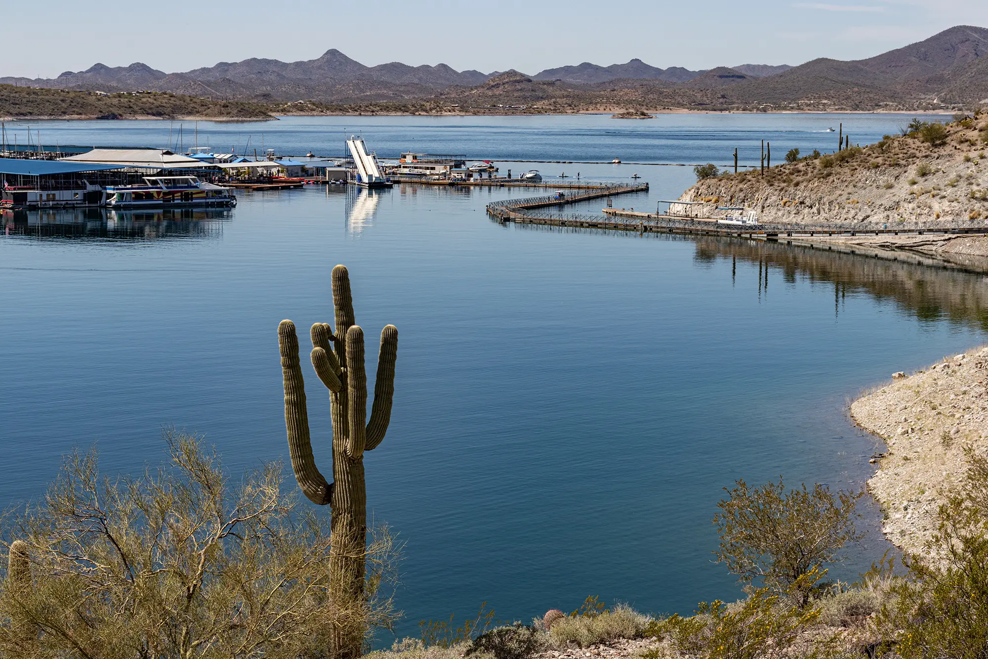
Over 10,000 acres of crystal-clear water surrounded by rugged Sonoran Desert landscape – and just 35 minutes from downtown Phoenix. Lake Pleasant is the Valley’s go-to destination for boating, fishing, diving, and weekend escapes. But beneath that blue surface, water levels shift with the seasons, submerged structures hide beneath the waterline, and today’s shoreline may look nothing like last month’s.
Lake Genius gives you the full picture. Daily underwater hazard updates, comprehensive points of interest, GPS navigation, trip planning from home, and full offline functionality – all built specifically for Lake Pleasant.


Free trial · No credit card · All Features Included
Why Lake Pleasant Boaters Use Lake Genius
Water levels move – and so do the hazards
Lake Pleasant’s water level fluctuates dramatically. Central Arizona Project water fills it from October to spring, reaching near capacity, then drops significantly through summer due to downstream demand. This seasonal swing means underwater terrain changes drastically; what was safe in April can be dangerously shallow by August–islands appear, coves shrink, and structure depth decreases. Lake Genius tracks these daily changes, providing up-to-date underwater awareness.
Submerged structures you can’t see from the surface
Lake Pleasant sits on top of the original Waddell Dam, flooded timber, rocky desert terrain, and submerged brush. The lake’s famous clear water lets you see a few feet down, but the real hazards are deeper – and invisible until it’s too late. The X-Ray View shows you what’s under the surface before you get there, highlighting hazards within 9 feet of the waterline so you can navigate around them instead of through them.
100+ miles of shoreline to explore
Lake Pleasant has more than 100 miles of shoreline tucked into desert coves, creek arms, and rocky inlets. Finding the best fishing spot, the quietest cove, or the closest fuel dock shouldn’t mean burning half your day searching. Lake Genius maps comprehensive points of interest across the entire lake – marinas, boat ramps, fishing spots, dive sites, hiking trailheads, camping areas, and more – all curated by the Lake Genius team.
Plan the trip before you leave home
Whether you’re trailering in from Phoenix, Scottsdale, Peoria, or Surprise, you want to hit the water with a plan. Lake Genius lets you scout the map, check today’s water level, mark your planned stops, and estimate distances – all from your couch. When you get to the ramp, you already know where you’re going.
See What’s Under Lake Pleasant – Updated Daily
Lake Pleasant’s underwater terrain is a mix of old dam structures, flooded timber, rocky desert formations, and seasonal vegetation that gets submerged as water levels rise. The X-Ray View gives you a simulated 3D look at what’s beneath the surface, with depth contours and the current shoreline highlighted in red. Zoom in on any area of the lake and see today’s underwater hazards – not last month’s.
The data updates daily based on the current water level. At Lake Pleasant, where levels can swing significantly between October and August, that daily refresh is the difference between navigating confidently and guessing.
TODAY’S WATER LEVEL
Today’s Water Level at Lake Pleasant
Lake Pleasant’s water level follows a seasonal cycle. Starting in October, the Central Arizona Project pumps water into the reservoir from the Colorado River, and levels climb through spring. By late May, downstream demand pulls the level back down through the summer months. That cycle means the lake you boat on in March is a different lake by July – shallower in places, with newly exposed shoreline, sandbars, and rock formations that were safely underwater just weeks earlier.
Lake Genius tracks the water level at Lake Pleasant daily. Open the app and tap the Water Level button to see the current reading in feet or meters. The shoreline is highlighted in red on your map so you can see exactly where the water boundary is today – not where it was when the map was printed.
Pro tip: Check the water level before you leave Wi-Fi. The reading updates daily, so pull it up at home or at the marina before you head out. Once your maps are downloaded, the core features work offline – but the latest water level update needs a quick internet connection.
MARINAS & BOAT RAMPS
Marinas & Boat Ramps at Lake Pleasant
Lake Pleasant has two full-service marinas and two public boat ramps, all mapped in Lake Genius with contact info, fuel availability, and services.
Pleasant Harbor Marina
Located on the southeastern shore, Pleasant Harbor is the closest marina entrance from Carefree Highway and the Phoenix metro area. Full-service marina with wet slips, dry storage, a fuel dock, boat repair center, convenience store, and boat rentals. Dillon’s Bayou Restaurant and Bar sits right on the water. Pleasant Harbor also operates an RV resort with over 250 full-hookup sites and dry camping options. It’s open 365 days a year.
Scorpion Bay Marina
On the western shore, Scorpion Bay is a floating marina community with covered and uncovered boat slips, hourly and daily boat rentals, kayak and paddleboard rentals, and a convenience store. The Scorpion Bay Grill is a floating restaurant with 360-degree water and desert views. A free electric tram runs between the parking lot and the dock. Scorpion Bay is also home to floating cabins for overnight stays on the water.
Public Boat Ramps
Lake Pleasant Regional Park has two public boat ramps: a 10-lane ramp on the south end with parking for 480 vehicles (355 with trailers) and a 4-lane ramp on the north end with parking for 112 trailer vehicles. Both have paved lots and restroom facilities. Both ramps are functional down to a water elevation of 1,600 feet. Weekend mornings fill up fast, especially in summer – plan your arrival accordingly.
Every marina and ramp is marked in Lake Genius with location, services, and contact details. Tap any marker on the map to get the info you need before you pull in.
FISHING, DIVING & DESERT ADVENTURES
Fishing, Diving & Desert Adventures at Lake Pleasant
- Fish smarter with the depth map
Lake Pleasant is one of the best bass lakes in the Phoenix area, with largemouth bass, striped bass, white bass, crappie, catfish, and bluegill all calling it home. The lake’s dramatic water level changes mean the fish move constantly – structure that held bass in spring may be high and dry by midsummer. Lake Genius’s depth contours and X-Ray View help you find submerged brush, timber, drop-offs, and channel edges where fish hold. You can also manually adjust the water level in the app to scout structure at different depths before you even launch.
Top fishing areas like Castle Creek, Humbug Creek, Cole’s Wash, Jackass Cove, and Honeymoon Cove are all marked as points of interest in the app. Whether you’re chasing stripers in 60 feet of water or working shallow coves for largemouth, you’ll know the terrain before you make your first cast.
- Dive one of the best inland sites in the Southwest
Lake Pleasant is widely recognized as one of the top inland scuba diving destinations in the western United States. With depths reaching 260 feet at capacity, plus underwater rock walls, canyons, and the remains of the original Waddell Dam, there’s plenty to explore below the surface. Visibility ranges from 25–30 feet in spring to 40–60 feet in winter. Lake Genius marks dive sites as points of interest and gives you depth contour data so you can plan your dive profile before you even gear up.
- Trails, wildlife, and desert landmarks
Lake Pleasant isn’t just about what’s on the water. The Yavapai Point Trail is a 3-mile out-and-back hike with 360-degree views of the lake, Bradshaw Mountains, and surrounding desert. Pipeline Canyon features a unique floating pedestrian bridge that connects trail sections during high water. Indian Mesa is home to the ruins of a Hohokam village built roughly 1,000 years ago, accessible via a 6.7-mile hike. And keep your eyes open for the wild burros that roam the shoreline and the bald eagles that nest in protected habitats around the lake.
All of these – trailheads, viewpoints, dive sites, fishing spots, and wildlife areas – are mapped as points of interest in Lake Genius. Mark your own favorites, add a photo to any marker, and share them with friends via text message.
Plan Your Lake Pleasant Trip From Home
Most Lake Pleasant visitors are coming from the Phoenix metro area – Peoria, Scottsdale, Surprise, Glendale, or Phoenix itself. The drive is short, but the lake is big. With over 10,000 acres of water and 100+ miles of shoreline, you want to know where you’re headed before you pull into the parking lot.
Lake Genius lets you explore the full Lake Pleasant map from home. Check today’s water level. Browse points of interest. Mark your planned stops – a fishing cove, a beach for the afternoon, the marina for fuel. Estimate travel distances between stops. Save your route and pull it up when you get to the ramp.
If you find a great spot, mark it with a custom pin. Take a photo of the cove, the rock formation, or the sunset spot and the app marks it on your map with the Photo Marker feature. Share any marker with friends or family via text message – they tap the link, the app opens, and the marker appears on their map automatically.
Lake Pleasant Weather
Lake Pleasant sits in the Sonoran Desert, and the weather plays a role in every trip. Summer temperatures regularly exceed 110°F, making hydration and shade essential. Monsoon season, typically June through September, can bring sudden afternoon thunderstorms with strong winds and lightning – conditions that move fast on open water.
Lake Genius gives you one-tap access to NOAA weather data for any point on the Lake Pleasant map. Tap your current location or any spot you’re planning to visit and see current conditions, wind speed, temperature, and precipitation. It’s the quick check that helps you decide whether to head out, adjust your plan, or wait for the storm to pass.
Works Offline – Even in the Remote Coves
While Lake Pleasant has better cell coverage than some of the more remote lakes Lake Genius covers, service can still be spotty once you’re deep into the northern coves, up the Agua Fria arm, or away from the main marina areas. And even when you have a signal, you don’t want to depend on it for navigation.
Download the Lake Pleasant map before your trip and every core feature works without an internet connection – the X-Ray View, points of interest, GPS tracking, saved routes, and custom markers. Weather and water level updates need a brief connection when accessed, so check those before you head out. After that, the app runs entirely on your device.
TESTIMONIALS
What Lake Pleasant Boaters Are Saying
TESTIMONIAL PLACEHOLDER #1
A testimonial about the overall app experience — ideally from a boater who used multiple features on a single trip. Example: someone who planned from home, used the X-Ray View on the water, and found a hidden cove via POI. Should convey “this app changed how I experience the lake.”
— John
- Bear Lake
TESTIMONIAL PLACEHOLDER #1
A testimonial focused on hazard avoidance or money saved — someone who spotted a hazard before it became a problem. Connects to the X-Ray View and water levels features. Should convey “this paid for itself immediately.”
— Steve
- Bear Lake
TESTIMONIAL PLACEHOLDER #1
A testimonial about offline reliability or trip planning from home — especially relevant for families or houseboat renters. Should convey “I was confident even in areas with no cell service” or “we planned the whole trip before we left.”
— Gabrielle
- Lake Powell
Frequently Asked Questions
What app do I need for Lake Pleasant?
What app do I need for Lake Pleasant?
Lake Genius is the boating app built specifically for Lake Pleasant. It includes daily underwater hazard updates with the X-Ray View, water level tracking, comprehensive points of interest covering marinas, fishing spots, dive sites, trailheads, and camping areas, plus GPS navigation, trip planning from home, and full offline functionality.
Does Lake Genius work offline at Lake Pleasant?
Does Lake Genius work offline at Lake Pleasant?
Yes. Download the Lake Pleasant map before your trip and every core feature works offline – including the X-Ray View, points of interest, GPS tracking, and saved routes. Weather and water level updates need a brief internet connection when accessed, so check those before you head out.
How do I check Lake Pleasant water levels?
How do I check Lake Pleasant water levels?
Lake Genius tracks the Lake Pleasant water level daily. Open the app and tap the Water Level button to see the current reading in feet or meters. The shoreline is highlighted in red on your map so you can see exactly where the water boundary is today.
What marinas are at Lake Pleasant?
What marinas are at Lake Pleasant?
Lake Pleasant has two full-service marinas: Pleasant Harbor Marina on the southeastern shore and Scorpion Bay Marina on the western shore. Both are mapped in Lake Genius with location, fuel availability, services, and contact details. The park also has a 10-lane and a 4-lane public boat ramp.
What fish are in Lake Pleasant?
What fish are in Lake Pleasant?
Lake Pleasant is home to largemouth bass, striped bass, white bass, crappie, bluegill, catfish, and more. It’s considered one of the best bass fishing lakes in the Phoenix area. Lake Genius maps popular fishing areas like Castle Creek, Humbug Creek, and Cole’s Wash, and the depth contours help you find submerged structure where fish hold.
Can you scuba dive at Lake Pleasant?
Can you scuba dive at Lake Pleasant?
Yes. Lake Pleasant is widely recognized as one of the best inland scuba diving sites in the Southwest, with depths reaching 260 feet, underwater rock walls, canyons, and the remains of the original Waddell Dam. Lake Genius marks dive sites and provides depth contour data to help you plan your dive.
How far is Lake Pleasant from Phoenix?
How far is Lake Pleasant from Phoenix?
Lake Pleasant is approximately 35 minutes from downtown Phoenix via I-17 and Carefree Highway. Pleasant Harbor Marina is the closest entrance, accessible off Carefree Highway and 87th Avenue. Scorpion Bay Marina is accessible via Castle Hot Springs Road. Use Lake Genius to plan your stops before you leave home.
Is there camping at Lake Pleasant?
Is there camping at Lake Pleasant?
Yes. Lake Pleasant Regional Park offers developed campgrounds at Roadrunner (72 RV sites with hookups) and Desert Tortoise, plus shoreline and primitive camping options. Pleasant Harbor Marina also operates an RV resort. All campgrounds are marked as points of interest in Lake Genius so you can plan your stay alongside your time on the water.
See It in Action at Lake Pleasant
Over 10,000 acres. Two marinas. 100+ miles of shoreline. Daily underwater hazard updates. Comprehensive points of interest. Full offline access. Lake Genius gives you everything you need to navigate Lake Pleasant with confidence – on your phone, ready when you are.
Start your free trial · No credit card · Works offline · $19.99/year