
Lake Mead Water Level – Updated Daily in the App
Lake Mead’s water level has been in the headlines for years. Whether it’s rising, dropping, or holding steady, one thing doesn’t change: you need to know where the water is today before you head out. Lake Genius tracks the water level at Lake Mead daily and displays today’s shoreline directly on your map – so you’re never guessing.


Start your free trial · No credit card required
The Lake Mead Water Level Story
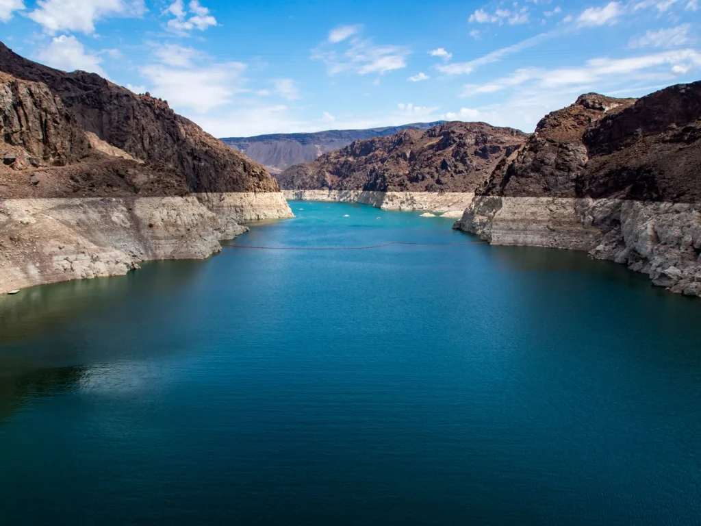
Lake Mead’s water level has been one of the most-watched environmental stories in the country. Years of drought pushed the reservoir to historic lows, exposing underwater formations that hadn’t seen daylight in decades. While levels have partially recovered in recent years, they continue to move – sometimes significantly from one season to the next.
For boaters, the headline numbers tell part of the story. What matters more is what’s happening beneath the surface today. As water levels move, underwater hazards shift with them. Rocks, ledges, and debris that were safely submerged last month might be within striking distance of your hull right now. That’s why daily tracking isn’t just interesting – it’s how you protect your boat and your crew.
Today’s Water Level at Lake Mead
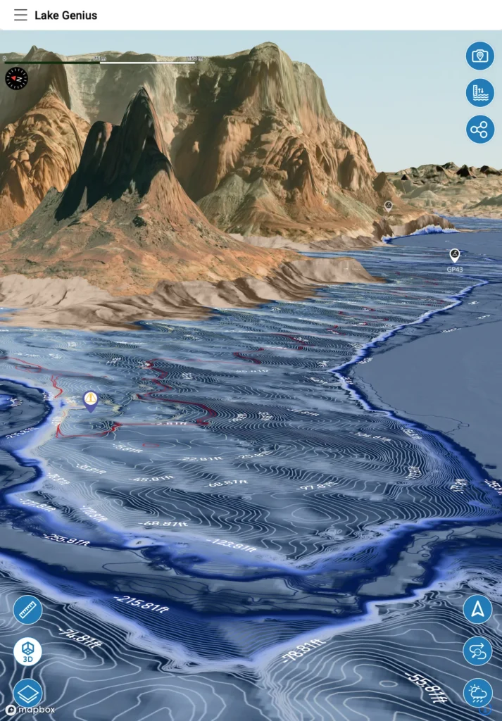
Lake Genius updates Lake Mead’s water level every day. Open the app, tap the Water Level button, and you’ll see the current reading in feet or meters – your choice. The shoreline is highlighted in red on your map, so you can see exactly where the water meets the land right now.
This isn’t a static number pulled from last month’s report. It’s today’s level, reflecting whatever’s been happening at the dam. Whether levels have been climbing after snowmelt or easing back during a dry stretch, you’ll know before you launch.
How Lake Genius Tracks Lake Mead’s Water Level
Lake Genius pulls Lake Mead’s water level from government monitoring data and runs it through a proprietary processing pipeline every day. That daily reading drives two things in the app:
First, it updates the red shoreline boundary on your map – so you always know where the water’s edge is today, not where it was when the map was printed. Second, it feeds directly into the X-Ray View, recalculating which underwater hazards are within 9 feet of the surface based on the current level.
You can view the level in feet or meters by toggling your preferred unit in settings. The reading updates daily, and if you’re planning a trip from home, you can check the level before you even pack the truck.
What Changing Levels Mean for Boaters at Lake Mead
When Lake Mead’s water level moves, everything underwater moves with it relative to the surface. A rock shelf that was safely 15 feet down last week might be at 8 feet today. A boat ramp that worked fine on your last visit might be high and dry. A cove you anchored in comfortably could be too shallow to enter.
These aren’t hypotheticals. Boat shops across Nevada and Arizona see $5,000–$10,000+ repair bills from underwater impacts on a regular basis. The damage often happens in areas boaters have visited before – they assumed the conditions were the same as last time.
Lake Genius takes the guesswork out of it. Check today’s level before you leave your Wi-Fi or cellular connection, and you’re covered for the day. The X-Ray View will show you exactly which hazards are near the surface at the current level – so you can steer around them instead of through them.
Pro Tip: Check Before You Leave Wi-Fi
Lake Mead has solid cell coverage near the marinas and the Las Vegas side, but once you head into the remote coves on the Arizona side or deeper into the Overton Arm, signal can get spotty. Here’s the best practice:
Check today’s water level in the app before you leave your Wi-Fi or cellular connection. The red shoreline boundary and underwater contour data are already part of your downloaded maps – they work offline. But pulling the absolute latest water level reading requires an internet connection when you access it. So check it at the marina, at camp, or at the hotel, and you’re set for the day.
Water Levels
+
the X-Ray View
Lake Mead’s well-documented water level history has reshaped the underwater landscape in ways that matter every time you’re on the water. Rocks and infrastructure that sat deep underwater a decade ago now hover near the surface. The X-Ray View uses today’s water level reading to show you exactly where those hazards are right now.
Here’s how the two features connect at Lake Mead:
The water level sets the baseline
Every day, the app pulls the current Lake Mead level from government monitoring data. That reading determines where the surface sits relative to everything beneath it.
The X-Ray View does the math
Using today’s level, the X-Ray View recalculates which rocks, ledges, and submerged structures are within 9 feet of the surface – the depth range where hulls, propellers, and anyone in the water are most at risk.
The red shoreline ties it together
The current water boundary shows in red on your map. Between the shoreline and the hazard layer, you’re looking at a daily-updated picture of what Lake Mead actually looks like beneath the surface – not what it looked like when a static chart was printed.
At a lake where water levels have moved as dramatically as Lake Mead’s, that daily recalculation is the difference between navigating on current information and navigating on assumptions.
TESTIMONIALS
What Lake Mead Boaters Are Saying
TESTIMONIAL PLACEHOLDER #1
A testimonial about the overall app experience — ideally from a boater who used multiple features on a single trip. Example: someone who planned from home, used the X-Ray View on the water, and found a hidden cove via POI. Should convey “this app changed how I experience the lake.”
— John
- Bear Lake
TESTIMONIAL PLACEHOLDER #1
A testimonial focused on hazard avoidance or money saved — someone who spotted a hazard before it became a problem. Connects to the X-Ray View and water levels features. Should convey “this paid for itself immediately.”
— Steve
- Bear Lake
TESTIMONIAL PLACEHOLDER #1
A testimonial about offline reliability or trip planning from home — especially relevant for families or houseboat renters. Should convey “I was confident even in areas with no cell service” or “we planned the whole trip before we left.”
— Gabrielle
- Lake Powell
Frequently Asked Questions
What is the current water level at Lake Mead?
What is the current water level at Lake Mead?
Lake Genius updates Lake Mead’s water level every day. Open the app, tap the Water Level button, and you’ll see the current reading in feet or meters. The red shoreline on your map shows exactly where the water’s edge is today.
Is Lake Mead water level rising or dropping?
Is Lake Mead water level rising or dropping?
It depends on the season and conditions in the Colorado River basin. Spring snowmelt often pushes levels up, while summer demand and evaporation can bring them back down. Lake Genius shows today’s actual level – not a prediction – so you always know where things stand right now.
How often are Lake Mead water levels updated in the app?
How often are Lake Mead water levels updated in the app?
Daily. Lake Genius pulls fresh water level data every day from official government monitoring sources. The level and the red shoreline on your map reflect today’s conditions, not last month’s.
How has Lake Mead’s water level changed over the years?
How has Lake Mead’s water level changed over the years?
Lake Mead hit historic lows in the early 2020s after years of drought. Levels have partially recovered since then but continue to fluctuate season to season. What matters for boaters is where the water is today, because underwater hazards shift as levels move. Lake Genius gives you that daily.
How deep is Lake Mead?
How deep is Lake Mead?
Lake Mead’s maximum depth varies with the water level, but it can exceed 500 feet at full pool near Hoover Dam. The depth changes across the reservoir – some areas are hundreds of feet deep, while others are surprisingly shallow, especially in coves. The Lake Genius map shows underwater terrain and depth contours so you can see what’s below the surface.
Do Lake Mead water level updates work offline?
Do Lake Mead water level updates work offline?
Partially. The red shoreline boundary and underwater contour data are included in your downloaded maps and work offline. To pull the very latest water level reading, you need an internet connection when you access it. Best practice: check the current level before you leave Wi-Fi or cellular coverage, and you’re set for the day.
See Where the Water Is Today
Lake Mead’s water level is always in the news. Lake Genius puts it in your pocket – updated daily, displayed on your map, and connected to the underwater hazard data that actually keeps your boat safe. Download the app, tap the Water Level button, and see today’s conditions for yourself.
Start your free trial · No credit card · $19.99/year for all lakes