
Flaming Gorge – 91 Miles of Canyon Reservoir Across Two States
Flaming Gorge stretches 91 miles across Utah and Wyoming – with dramatic red canyon walls at the south end, wide-open water in the north, and some of the best lake trout and Kokanee fishing in the West.
Lake Genius is built for it. Daily underwater hazard updates, 2,000+ points of interest, GPS route tracking, and full offline maps – so you navigate the canyons, find the fishing structure, and know what’s under the water before you anchor.


Start your free trial · No credit card · Works offline
Why Flaming Gorge Needs Lake Genius
Flaming Gorge is one of the most dramatic reservoirs in the West – 91 miles of canyon walls, open water, and changing geography across two states. Here’s why the right app matters.

Canyon walls hide what's beneath them
Red Canyon, Sheep Creek Bay, and the southern arms have submerged rocks, ledges, and drawdown-exposed structure that can wreck a prop fast. The X-Ray View shows what’s beneath the surface so you steer clear.

Cell service is patchy across 91 miles
You’ll have signal at Lucerne Valley and Cedar Springs Marinas, but coverage drops through the canyon arms and across the open Wyoming waters. Offline maps mean your navigation, POIs, and routes keep working when bars don’t.
Water levels move with dam operations and seasonal drawdown
Flaming Gorge Dam controls the level, and seasonal releases can shift the shoreline by tens of feet. That affects launch ramp access – especially at Buckboard Crossing and Antelope Flat. Lake Genius tracks the level daily.

Two states, two sets of rules
Utah and Wyoming each have their own fishing licenses, boat registration requirements, and seasonal regulations on the reservoir. Plan your trip from home with Lake Genius so you know what you need before you launch.
UNDERWATER TERRAIN
See What's Under the Water at Flaming Gorge
The X-Ray View is Lake Genius’s signature feature, and it earns its keep at Flaming Gorge – especially in the canyon arms where the underwater terrain drops off sharply and seasonal drawdown exposes submerged structure that wasn’t there last year.
Zoom into any area of the Flaming Gorge map and the app reveals a 3D visualization of the underwater terrain. Rocks, ledges, and hazards within 9 feet of the surface become visible. The shoreline is highlighted in red. And the data updates every night at midnight, so you’re seeing today’s conditions, not last season’s.
No other boating app updates underwater hazards daily for Flaming Gorge.
The X-Ray View is included in your free trial
Flaming Gorge
Water Level – Updated Daily
Flaming Gorge’s water level is controlled by Flaming Gorge Dam at the south end – with seasonal drawdown for hydropower and downstream Green River flows that can swing the reservoir by tens of feet across a year. Spring runoff fills it up; late-summer and fall draw it back down.
That swing matters. It affects which ramps stay usable – Buckboard Crossing and Antelope Flat are particularly water-level-sensitive – and it changes which canyon arms hold the structure anglers fish. Lake Genius tracks Flaming Gorge’s level daily, updating at midnight. Open the app and see today’s reading in feet or meters, with the current shoreline highlighted in red on your map. Use it to check conditions before you launch – or before you tow north to Wyoming where the ramps swing the most.
Flaming Gorge Marinas & Launch Ramps – All Mapped in the App
Flaming Gorge’s marinas and launches span both states – three in Utah at the south and middle, one in Wyoming to the north, plus a major USFS boat ramp. Lake Genius maps every one with contact details, services, and navigation – online and off.
Lucerne Valley Marina
West-shore Utah marina seven miles east of Manila, offering the reservoir’s only houseboat and floating-cabin rentals, day-boat rentals, fuel, pump-out, store, campground, and a seasonal boat-accessible restaurant.
Cedar Springs Marina
Utah-side marina two miles from Flaming Gorge Dam near Dutch John, with daily boat rentals, guided fishing, lake tours, fuel, pump-out, store, and a seasonal boat-accessible restaurant.
Buckboard Crossing Marina
North-end Wyoming marina about 25 miles south of Green River, with launch ramp, fuel, daily boat rentals, store, pump-out, and adjacent USFS campground. Season runs roughly May–September.
Antelope Flat Boat Ramp
USFS ramp on the Utah side about 10 miles northwest of Dutch John, with paved launch, courtesy dock, trailer parking, and an adjacent campground. No fuel or rentals.
Flaming Gorge Resort
Lodging-and-rental operation along US-191 near Dutch John offering raft, kayak, and paddleboard rentals plus guided fishing. Not a marina – no on-water launch on site.
All marinas and launches are mapped as points of interest in the Lake Genius app, with details and navigation available offline.
Explore Flaming Gorge – Red Canyon, Sheep Creek & World-Class Fishing
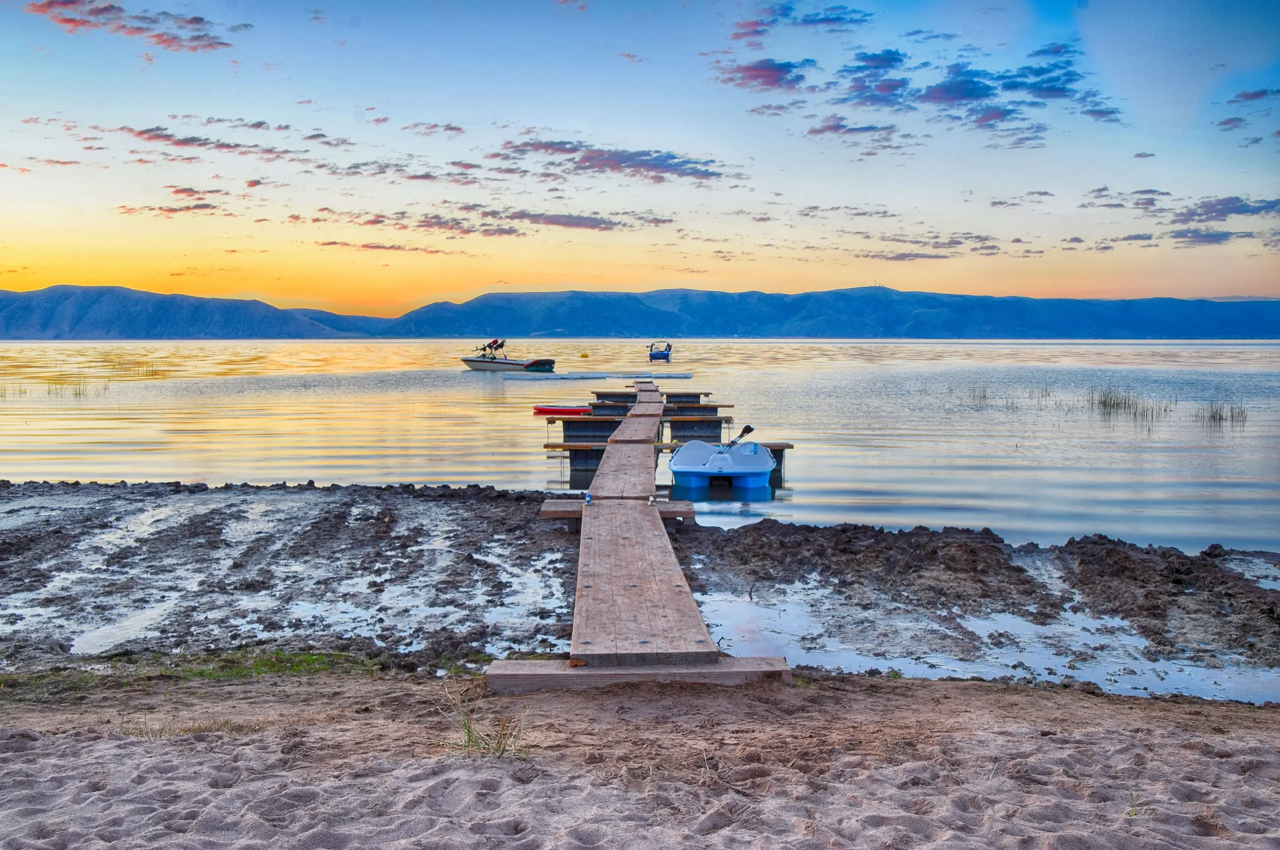
Flaming Gorge is two reservoirs in one map – dramatic canyon water at the Utah south end, wide-open boating in the Wyoming north, and arguably the best lake trout fishery in the lower 48. The Lake Genius map shows you what generic boating apps don’t – depth contours, underwater hazards, curated points of interest, and the routes that connect them all.
- Red Canyon & Flaming Gorge Dam (UT) – The dramatic south end, with sheer red sandstone walls that earned the reservoir its name. Mapped with anchorage details and the dam viewing area.
- Sheep Creek Bay & Hideout Canyon (UT) – Secluded canyon arms with mapped depths and quiet anchorages – the Lake-Powell-style scenery without the Powell crowds.
- Antelope Flat & the Wyoming open water – Wider, more typical reservoir geometry where the wind picks up in the afternoons. Mapped wind-protected coves and ramp access.
- Lake trout, Kokanee & Burbot structure – Flaming Gorge is a fishing destination first for many boaters. Mapped depth contours help you find the structure where Macs hold deep, Kokanee schools run, and Burbot (an invasive species – anglers must kill all caught) move in the shallows.
Save your own favorite spots and they’re there next year, mapped for offline use. Download the Flaming Gorge map once and use it offline anywhere – the canyon arms, the open Wyoming waters, or out toward the dam.
Plan Your Flaming Gorge Trip Before You Leave Home
Flaming Gorge spans two states and 91 miles, with very different boating depending on where you launch. Open Lake Genius at home and you can browse the full map, compare Lucerne Valley, Cedar Springs, and Buckboard Crossing, check the canyon arms versus the open Wyoming water, mark your fishing spots, and build a route. When you launch, your plan is on your phone – and it works offline once you’ve downloaded the map.
Flaming Gorge Weather – One Tap Away
Afternoon wind picks up fast across the Wyoming open water, and summer thunderstorms can build over the Uintas with little warning. Lake Genius gives you one-tap access to NOAA weather data for any point on the reservoir. Check conditions before you launch, or pull up a forecast for the arm you’re heading to. Weather checks require cellular service.
Works Offline – From Red Canyon to the Wyoming Waters
Flaming Gorge has signal at the main marinas, but coverage drops through the canyon arms and across stretches of the Wyoming open water. Lake Genius works completely offline once you’ve downloaded the Flaming Gorge map – at home, at the hotel, or at the marina while you still have Wi-Fi. The X-Ray View, all 2,000+ points of interest, GPS tracking, saved routes, and photo markers all work without a signal. Weather and water-level updates need internet, so check those before you launch.
TESTIMONIALS
What Bear Lake Visitors Are Saying
TESTIMONIAL PLACEHOLDER #1
A testimonial about the overall app experience u2014 ideally from a boater who used multiple features on a single trip. Example: someone who planned from home, used the X-Ray View on the water, and found a hidden cove via POI. Should convey u201cthis app changed how I experience the lake.u201d
u2014 John
- Bear Lake
TESTIMONIAL PLACEHOLDER #1
A testimonial focused on hazard avoidance or money saved u2014 someone who spotted a hazard before it became a problem. Connects to the X-Ray View and water levels features. Should convey u201cthis paid for itself immediately.u201d
u2014 Steve
- Bear Lake
TESTIMONIAL PLACEHOLDER #1
A testimonial about offline reliability or trip planning from home u2014 especially relevant for families or houseboat renters. Should convey u201cI was confident even in areas with no cell serviceu201d or u201cwe planned the whole trip before we left.u201d
u2014 Gabrielle
- Lake Powell
TESTIMONIALS
What Lake Genius Users Are Saying
Very useful app
We’ve taken several family houseboat trips to the lake in years past. We normally relied on maps. I was happy to find an affordable electronic option when I learned of Lake Genius, so downloaded it and subscribed prior to our trip in mid-October 2025. Looking at the app at home I was impressed with the amount of detail concerning elevations and landmarks. In use on the lake, I had a hard time finding a zoom level that would show me both buoy locations and enough elevation / depth information to be useful while underway, but recent updates have fixed that. We found the app very useful!
— DonJ60
- Apple App Store, Jan 2
Frequently Asked Questions
What app do I need for Flaming Gorge?
What app do I need for Flaming Gorge?
Lake Genius is the boating app built for Flaming Gorge. It includes daily underwater hazard updates (the X-Ray View), water level tracking, 2,000+ curated points of interest, GPS navigation, trip planning, and full offline functionality.
Does Lake Genius work offline at Flaming Gorge?
Does Lake Genius work offline at Flaming Gorge?
Yes. Download the Flaming Gorge map before your trip and every core feature works offline – the X-Ray View, points of interest, GPS tracking, and saved routes. Weather and water level updates require internet, so check those before launch.
How do I check Flaming Gorge water levels?
How do I check Flaming Gorge water levels?
Lake Genius tracks Flaming Gorge’s water level daily, updating at midnight. Open the app and you’ll see today’s reading in feet or meters, with the current shoreline highlighted in red on your map. The level moves with dam operations and seasonal drawdown, so check before you tow.
What marinas are at Flaming Gorge Reservoir?
What marinas are at Flaming Gorge Reservoir?
Lake Genius maps every Flaming Gorge marina and major launch – Lucerne Valley Marina (UT, west shore), Cedar Springs Marina (UT, near the dam), Buckboard Crossing Marina (WY, north), Antelope Flat Boat Ramp (UT, USFS), and Flaming Gorge Resort (UT, rentals and lodging, no on-water launch).
Is there a Flaming Gorge map I can download for offline use?
Is there a Flaming Gorge map I can download for offline use?
Yes. Lake Genius lets you download the full Flaming Gorge map – depth contours, underwater hazards, marinas, canyon arms, and 2,000+ points of interest – to your phone for offline use. Once downloaded, the map and all core features work without cell service.
What kinds of fish are in Flaming Gorge?
What kinds of fish are in Flaming Gorge?
Flaming Gorge is known for trophy lake trout (Mac), Kokanee salmon, rainbow trout, and smallmouth bass – plus Burbot, an invasive species that anglers are required to kill on the catch. Lake Genius maps depth contours to help you find structure where each species holds.
Is Flaming Gorge in Utah or Wyoming?
Is Flaming Gorge in Utah or Wyoming?
Both. Flaming Gorge Reservoir spans the Utah–Wyoming state line. The dramatic canyon south end is in Utah; the wider open-water north is in Wyoming. Each state has its own fishing license and boating regulations on the reservoir, so check before you launch.
How much does Lake Genius cost for Flaming Gorge?
How much does Lake Genius cost for Flaming Gorge?
$19.99 per year covers every lake covered by Lake Genius, with every feature included. You can try the full app free with a 2-hour trial, no credit card required.
Explore Flaming Gorge With Confidence
91 miles of canyon reservoir. Two states. World-class fishing. Some of the most dramatic boating scenery in the West. Flaming Gorge rewards the prepared – and Lake Genius makes sure you are. Download the app, plan from home, and see what’s under the water before your next trip.
Start your free trial · No credit card · Works offline · $19.99/year