Lake Roosevelt – Arizona’s Biggest Lake, Mapped for Boaters
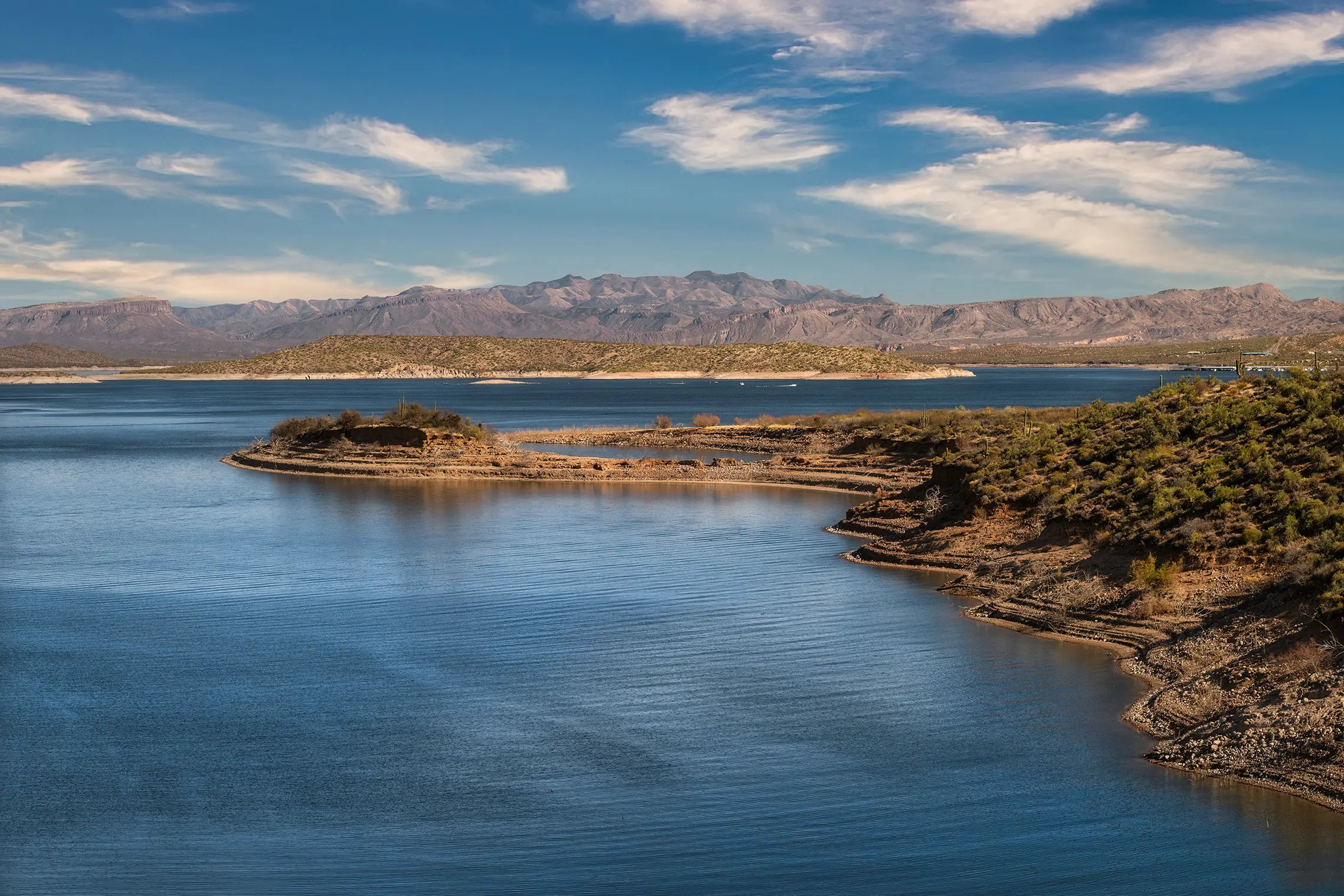
Roosevelt Lake is 21,500 acres of deep blue water set against the red rock of Arizona’s Tonto Basin. With 128 miles of shoreline, trophy bass fishing, miles of beach camping, and water levels that move with the seasons, it’s one of the most rewarding – and most unpredictable – lakes in the state. Lake Genius gives you the tools to navigate it with confidence.


Free trial · All Features · No credit card required
Why Roosevelt Lake Boaters Use Lake Genius
Roosevelt Lake, managed by Salt River Project, is a working reservoir with fluctuating water levels due to water releases, irrigation demand, and seasonal runoff. This constant change creates hazards for boaters like submerged timber, rock ledges, and shifting shorelines across the 128 miles of shoreline.
Lake Genius solves these challenges. The app provides daily underwater hazard updates, curated points of interest, offline maps, and GPS navigation to enhance your time on the water.
Key features include:
Water Levels
Daily tracking of fluctuating water levels based on SRP operations and runoff.
Hazards
“X-Ray View” shows submerged timber, rock ledges, and old creek beds within 9 feet of the surface, updated daily as water levels change.
Navigation
Maps every marina, boat ramp, campsite, and point of interest across the 128 miles of shoreline.
Points of Interest
Hundreds of curated fishing, beach, and camping spots maintained by our team, providing local knowledge.
See What’s Under Roosevelt Lake – Updated Daily
Roosevelt Lake sits in a flooded river basin with submerged timber, old creek beds, and rocky terrain that shifts in and out of the hazard zone as water levels move. The X-Ray View is Lake Genius’s signature feature – a simulated 3D visualization that shows you the underwater landscape beneath the surface, updated every day based on the current water level.
Zoom into any part of the lake and the X-Ray View reveals elevation contours beneath the water. Hazards within 9 feet of the surface are highlighted. The shoreline is marked in red so you always see where the water’s edge is today – not where it was last week.
No other boating app updates underwater hazards daily for Roosevelt Lake. Most tools rely on static data that doesn’t account for the level changes that happen here throughout the year.
TODAY’S WATER LEVEL
Roosevelt Lake Water Level – Updated Daily
Roosevelt Lake is a working reservoir. Salt River Project manages water releases for irrigation, power generation, and flood control – which means water levels here move throughout the year, sometimes by dozens of feet between seasons. The lake can drop significantly in late summer and fall, then refill from winter snowmelt and spring runoff from the Salt River and Tonto Creek.
For boaters, those changes directly affect which boat ramps are accessible, where the shoreline is, and which underwater features are close to the surface. Lake Genius tracks Roosevelt Lake’s water level daily so you always know what to expect before you launch.
The best practice: check the latest water level before you leave Wi-Fi or cellular coverage and you’re covered for the day. The app uses the current level to calculate the X-Ray View, adjust the red shoreline, and show you which hazards are near the surface right now.
MARINAS & BOAT RAMPS
Roosevelt Lake Marinas & Boat Ramps – All Mapped in the App
Roosevelt Lake has one full-service marina and multiple boat ramps managed by the Tonto National Forest. Lake Genius maps every launch point with location details and navigation so you always know where to go – and which ramps are accessible at the current water level.
Roosevelt Lake Marina
The primary full-service marina on the lake, located off State Route 188 near the town of Roosevelt. Boat slips (covered and uncovered), dry storage, a paved boat ramp, fuel, an on-site restaurant, a convenience store, and boat rentals. This is the central hub for most boaters on the lake.
Windy Hill Recreation Site
One of the most popular launch points on the lake. Multiple boat ramps, ample trailer parking, restrooms, showers, a playground, and a campground. Located southeast of the dam.
Cholla Recreation Site
Another major launching hub on Roosevelt Lake’s western shore. Multi-lane boat ramp, parking, restrooms, and a well-equipped campground with showers. Nearby Cholla Bay provides additional amenities.
Indian Point Recreation Site
A quieter launch point on the lake with a boat ramp and basic facilities. Good access to the northern reaches of Roosevelt Lake.
Grapevine Group Site
Popular for group outings, with a boat ramp, group picnic areas, restrooms, and a campground. Paved road access.
Schoolhouse Recreation Site
Additional boat ramp access along the western shore.
All marinas and boat ramps are mapped as points of interest in the Lake Genius app, with details and navigation available online and offline.
EXPLORE ROOSEVELT LAKE
Explore Roosevelt Lake – History, Fishing, Camping & More
Roosevelt Lake isn’t just a boating destination – it’s surrounded by history, wildlife, and some of the best outdoor recreation in central Arizona. Lake Genius maps hundreds of curated points of interest across the lake and surrounding area so you can find what you’re looking for without guessing.
- Historic Landmarks
Roosevelt Lake is defined by its landmarks. Theodore Roosevelt Dam, completed in 1911, was once the world’s largest masonry dam and remains one of Arizona’s most impressive engineering feats. The Theodore Roosevelt Dam Overlook offers upper and lower gazebos with direct views of the dam face, floodgates, and powerhouse.
The Roosevelt Lake Bridge is a 1,080-foot painted blue steel arch – the longest two-lane, single-span steel-arch bridge in North America. It’s a photographer’s landmark, especially at sunrise with the Four Peaks mountains in the background.
Inspiration Point Interpretive Overlook, a short detour off the main road, gives you the full “postcard view” – the lake, the bridge, and the back of the dam all in one frame.
- Tonto National Monument & Cliff Dwellings
Just south of the lake, Tonto National Monument preserves two Salado cliff dwellings dating back to 1250 CE. The Lower Cliff Dwelling is accessible via a steep half-mile paved trail with panoramic views of the reservoir. The Upper Cliff Dwelling – a larger site that once housed up to 100 people – is accessible only via ranger-led guided hikes from November through April. The Roosevelt Lake Visitors Center features artifacts from the Salado culture, including 600-year-old pottery and woven textiles.
- Fishing at Roosevelt Lake
Roosevelt Lake is one of Arizona’s premier fishing destinations – known for trophy-sized largemouth and smallmouth bass, channel catfish, crappie, and sunfish. Nearly 20,000 acres of water and submerged timber create the kind of structure that serious anglers look for.
Lake Genius helps you fish smarter. The X-Ray View shows underwater structure and depth contours so you can scout drop-offs, submerged timber, and creek channels before you cast. You can also set the water level manually to explore how terrain changes at different depths – a useful trick for finding where fish are holding.
- Shoreline Camping
One of Roosevelt Lake’s standout features is miles of beach area available for camping – depending on water levels. Popular developed campgrounds include Cholla Campground (206 sites with modern showers), Windy Hill, and Frazier Campground. Several primitive camping areas including Bachelor Cove, Cholla Bay, Bermuda Flat, and Grapevine Wash offer more secluded options.
Water levels directly affect which beaches and campsites are accessible. Checking the app before you head out helps you find spots that are open and reachable at today’s water level.
- Trails & Wildlife
The Arizona Trail – an 800-mile cross-state route – passes through the Roosevelt Lake area, crossing the Salt River via the Roosevelt Lake Bridge. The Vineyard Trail offers 8.5 miles of elevation gain with expansive views of the Tonto Basin. Roosevelt Lake is also a winter habitat for bald eagles, osprey, and migratory waterfowl, and its distance from major cities makes it excellent for stargazing and night sky photography.
Plan Your Roosevelt Lake Trip Before You Leave Home
Roosevelt Lake is about 80 miles northeast of Phoenix – close enough for a day trip, far enough that you want a plan before you get there. Lake Genius lets you explore the entire lake from your couch. Browse points of interest, check the current water level, plan your route, and mark the spots you want to hit – all before you load up the truck.
Mark your planned stops, estimate travel distances on the water, and save routes for future visits. When you get to the lake, your plan is already on your phone – ready to go, even without cell service.
Heading out with a group? Share your markers and meeting points with other Lake Genius users via text message. Everyone arrives on the same page.
Roosevelt Lake Weather – Check Before You Head Out
Roosevelt Lake sits at about 2,150 feet elevation in the Sonoran Desert. Summer temperatures regularly push past 100°F, and afternoon thunderstorms can develop fast over the Tonto Basin – bringing high winds, lightning, and choppy water with little warning.
Lake Genius gives you one-tap access to NOAA weather data for any point on Roosevelt Lake. Tap your current location or any spot on the map and get the latest conditions, wind, temperature, and precipitation forecast. It’s the quickest way to check conditions before you leave the dock or head across the lake.
Works Offline – Even in Remote Parts of the Lake
Cell service at Roosevelt Lake is spotty at best. You may have coverage near State Route 188 and the marina, but once you head into the northern arms or more remote stretches of shoreline, signal drops off. Lake Genius is built for this.
Download the Roosevelt Lake map before your trip and the full app works without any internet connection. The interactive map, X-Ray View, all your points of interest, GPS navigation, and saved routes all function offline. Weather and water level pulls need a brief connection, but the core map and navigation are fully offline-capable.
Best practice: grab the latest water level and weather check while you still have Wi-Fi or cellular, then you’re covered for the day.
TESTIMONIALS
What Roosevelt Lake Boaters Are Saying
TESTIMONIAL PLACEHOLDER #1
A testimonial about the overall app experience — ideally from a boater who used multiple features on a single trip. Example: someone who planned from home, used the X-Ray View on the water, and found a hidden cove via POI. Should convey “this app changed how I experience the lake.”
— John
- Bear Lake
TESTIMONIAL PLACEHOLDER #1
A testimonial focused on hazard avoidance or money saved — someone who spotted a hazard before it became a problem. Connects to the X-Ray View and water levels features. Should convey “this paid for itself immediately.”
— Steve
- Bear Lake
TESTIMONIAL PLACEHOLDER #1
A testimonial about offline reliability or trip planning from home — especially relevant for families or houseboat renters. Should convey “I was confident even in areas with no cell service” or “we planned the whole trip before we left.”
— Gabrielle
- Lake Powell
Frequently Asked Questions
What app do I need for Roosevelt Lake?
What app do I need for Roosevelt Lake?
Lake Genius is a boating app that covers Roosevelt Lake with daily underwater hazard updates, hundreds of curated points of interest, offline maps, GPS navigation, and weather notices. It’s available on iOS and Android with a fully-featured free trial.
What is the current water level at Roosevelt Lake?
What is the current water level at Roosevelt Lake?
Lake Genius tracks Roosevelt Lake’s water level daily. Open the app, tap the Water Level button, and see the current reading in feet or meters. Water levels at Roosevelt Lake fluctuate throughout the year based on Salt River Project operations and seasonal runoff.
Is Roosevelt Lake good for fishing?
Is Roosevelt Lake good for fishing?
Roosevelt Lake is one of Arizona’s top fishing lakes, known for trophy largemouth and smallmouth bass, channel catfish, crappie, and sunfish. The lake’s submerged timber and varied underwater terrain create excellent fish habitat. Lake Genius’s X-Ray View helps you find underwater structure, drop-offs, and creek channels where fish hold.
Does Lake Genius work offline at Roosevelt Lake?
Does Lake Genius work offline at Roosevelt Lake?
Yes. Download the Roosevelt Lake map before your trip and the full app works without cell service. The interactive map, X-Ray View, points of interest, GPS, and saved routes all function offline. Weather and water level pulls need a brief connection.
How far is Roosevelt Lake from Phoenix?
How far is Roosevelt Lake from Phoenix?
Roosevelt Lake is approximately 80 miles northeast of Phoenix, about a 90-minute drive via the Bush Highway and State Route 188. It’s close enough for a day trip and a popular weekend destination for Phoenix-area boaters.
Where can I launch a boat at Roosevelt Lake?
Where can I launch a boat at Roosevelt Lake?
Roosevelt Lake has multiple boat ramps managed by the Tonto National Forest, including Windy Hill, Cholla, Indian Point, Grapevine, and Schoolhouse recreation sites. Roosevelt Lake Marina also has a paved boat ramp. Water level fluctuations can affect ramp accessibility – check the app for current conditions before you drive out.
Can I camp at Roosevelt Lake?
Can I camp at Roosevelt Lake?
Yes. Roosevelt Lake offers both developed campgrounds (Cholla with 206 sites and modern showers, Windy Hill, Frazier) and primitive camping areas (Bachelor Cove, Cholla Bay, Bermuda Flat, Grapevine Wash). The lake is known for miles of beach camping that shifts with water levels. Lake Genius helps you find accessible camping spots at the current water level.
How big is Roosevelt Lake?
How big is Roosevelt Lake?
Roosevelt Lake (Theodore Roosevelt Lake) is the largest lake entirely within Arizona. At full capacity, it covers approximately 21,500 acres with 128 miles of shoreline, stretching over 22 miles long and up to two miles wide. It was created by Theodore Roosevelt Dam, completed in 1911 on the Salt River.
Get the App That Knows Roosevelt Lake
21,500 acres. 128 miles of shoreline. Daily underwater hazard updates. Hundreds of curated points of interest. Full offline access. Lake Genius gives you everything you need to navigate Roosevelt Lake with confidence – on your phone, ready when you are.
Start your free trial · No credit card · Works offline · $19.99/year