
Lake Mohave – 237 Miles of Shoreline Between Hoover and Davis Dam
Lake Mohave runs 67 miles between Hoover Dam and Davis Dam, with 237 miles of shoreline, hot springs in the canyon below Hoover, and the quieter water boaters head to when Lake Mead gets crowded.
Lake Genius is built for it. Daily underwater hazard updates, 2,000+ points of interest, GPS route tracking, and full offline maps – so you find the springs, navigate the canyon, and know what’s under the water before you anchor.


Start your free trial · No credit card · Works offline
Why Lake Mohave Needs Lake Genius
Lake Mohave’s a long, narrow reservoir with a split personality – sheer canyon cliffs at the north, sandy coves through the middle, a busy marina at the south. Here’s why the right app matters.

Underwater hazards in the canyon
The Black Canyon section near Hoover Dam runs narrow and deep, with submerged rocks and steep ledges close to the surface in places that look safe from above. The X-Ray View shows what’s beneath the surface so you steer clear.

Cell service drops between the marinas
You’ll have signal at Katherine Landing and Cottonwood Cove, but coverage thins out in the canyon section between Willow Beach and Cottonwood and along stretches of the AZ shoreline. Offline maps keep navigation, POIs, and routes working when bars don’t.

Water levels move with dam operations
Mohave’s level is controlled by Hoover Dam upstream and Davis Dam downstream. Daily release schedules and seasonal drawdown shift the shoreline and affect which free launches stay usable. Lake Genius tracks the level daily so you know before you tow.

The geography is confusing for first-timers
Three main marinas, two states, free launches that only work at certain water levels, and 237 miles of shoreline to figure out. Plan your trip from home with Lake Genius so you know which side to launch from before you arrive.
UNDERWATER TERRAIN
See What's Under the Water at Lake Mohave
The X-Ray View is Lake Genius’s signature feature, and it earns its keep at Lake Mohave – especially in the Black Canyon section where the underwater terrain is steepest.
Zoom into any area of the Lake Mohave map and the app reveals a 3D visualization of the underwater terrain. Rocks, ledges, and hazards within 9 feet of the surface become visible. The shoreline is highlighted in red. And the data updates every night at midnight, so you’re seeing today’s conditions, not last season’s.
No other boating app updates underwater hazards daily for Lake Mohave.
The X-Ray View is included in your free trial
Lake Mohave
Water Level – Updated Daily
Lake Mohave is one of the most managed reservoirs in the West – sitting between Hoover Dam upstream and Davis Dam downstream, with water levels that move daily based on hydropower releases, downstream demand, and seasonal Colorado River allocations.
That movement matters. A few feet up or down changes which free ramps are usable, whether the approach to Princess Cove or Telephone Cove is deep enough to launch, and how the shoreline at your favorite anchorage actually looks today. Lake Genius tracks Lake Mohave’s level daily, updating at midnight. Open the app and see the current reading in feet or meters, with the shoreline highlighted in red on your map. Use it to check conditions before launching – or before you tow to a free ramp that might not be open this week.
Lake Mohave Marinas & Launch Ramps – All Mapped in the App
Lake Mohave’s marinas and free launches stretch the full 67 miles between the dams, across two states. Lake Genius maps every one with contact details, services, and navigation – online and off.
Katherine Landing
South-end full-service marina near Bullhead City, AZ, with boat and houseboat rentals, fuel dock, lodging, camping, dining, store, and on-water repairs. The busiest marina on the lake.
Cottonwood Cove Resort & Marina
Mid-lake marina on the Nevada side west of Searchlight, with launch ramp, fuel dock, boat and houseboat rentals, motel, RV park, store, cafe, and dry storage.
Willow Beach Marina
North-end Arizona-side marina downstream of Hoover Dam, offering boat rentals, fuel, a small store, and trout-fishing access. The quietest of the three marinas.
Princess Cove Launch
Free unpaved NPS launch on the Nevada side near Cottonwood Cove, suitable for smaller trailered boats. No fuel, dock, or services.
Telephone Cove Launch
Free dirt-and-gravel launch on the Arizona side north of Bullhead City, popular with day boaters and campers. No services, and ramp condition varies with water level.
Nelson's Landing / Placer Cove
Free primitive launch on the Nevada side via Eldorado Canyon Road, with steep gravel access and no services. Usable only when reservoir levels allow.
All marinas and launches are mapped as points of interest in the Lake Genius app, with details and navigation available offline.
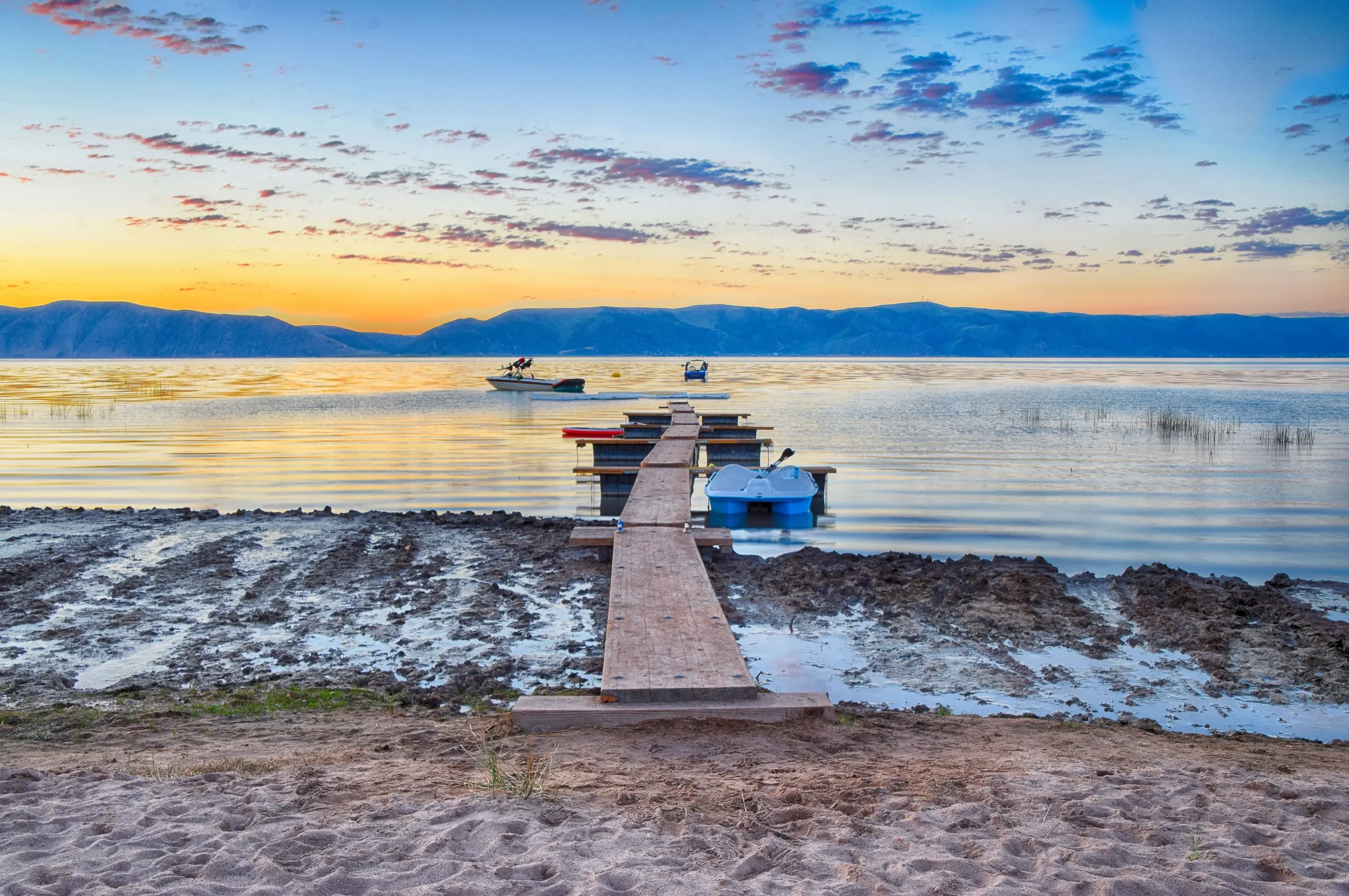
Explore Lake Mohave – Hot Springs, Black Canyon & Hidden Coves
Lake Mohave is the quieter side of the Lake Mead National Recreation Area – a 67-mile reservoir with sheer canyon walls at the north, sandy coves through the middle, and one of the most distinctive boating destinations in the West below Hoover Dam. The Lake Genius map shows you what generic boating apps don’t – depth contours, underwater hazards, curated points of interest, and the routes that connect them all.
Save your own favorite spots and they’re there next year, mapped for offline use. Download the Lake Mohave map once and use it offline anywhere – the canyon, the open water, or out toward Davis Dam.
Plan Your Lake Mohave Trip Before You Leave Home
The first question every Mohave first-timer asks is which side to launch from. Open Lake Genius at home and you can browse the full Lake Mohave map, compare Katherine Landing, Cottonwood Cove, and Willow Beach, check the free-launch ramps, mark the coves you want to anchor at, and build a route. When you launch, your plan is on your phone – and it works offline once you’ve downloaded the map.
Lake Mohave Weather – One Tap Away
Wind funnels through the Black Canyon section fast, and afternoon storms build over the desert ranges with little warning – especially in summer. Lake Genius gives you one-tap access to NOAA weather data for any point on Lake Mohave. Check conditions before you launch, or pull up a forecast for the cove you’re heading to. Weather checks require cellular service.
Works Offline – From Hoover to Davis
Lake Mohave has signal at the main marinas, but coverage thins out fast in the canyon between Willow Beach and Cottonwood Cove and along stretches of the AZ shoreline. Lake Genius works completely offline once you’ve downloaded the Lake Mohave map – at home, at the hotel, or at the marina while you still have Wi-Fi. The X-Ray View, all 2,000+ points of interest, GPS tracking, saved routes, and photo markers all work without a signal. Weather and water-level updates need internet, so check those before you launch.
TESTIMONIALS
What Bear Lake Visitors Are Saying
TESTIMONIAL PLACEHOLDER #1
A testimonial about the overall app experience u2014 ideally from a boater who used multiple features on a single trip. Example: someone who planned from home, used the X-Ray View on the water, and found a hidden cove via POI. Should convey u201cthis app changed how I experience the lake.u201d
u2014 John
- Bear Lake
TESTIMONIAL PLACEHOLDER #1
A testimonial focused on hazard avoidance or money saved u2014 someone who spotted a hazard before it became a problem. Connects to the X-Ray View and water levels features. Should convey u201cthis paid for itself immediately.u201d
u2014 Steve
- Bear Lake
TESTIMONIAL PLACEHOLDER #1
A testimonial about offline reliability or trip planning from home u2014 especially relevant for families or houseboat renters. Should convey u201cI was confident even in areas with no cell serviceu201d or u201cwe planned the whole trip before we left.u201d
u2014 Gabrielle
- Lake Powell
TESTIMONIALS
What Lake Genius Users Are Sayinge Saying
Very useful app
We’ve taken several family houseboat trips to the lake in years past. We normally relied on maps. I was happy to find an affordable electronic option when I learned of Lake Genius, so downloaded it and subscribed prior to our trip in mid-October 2025. Looking at the app at home I was impressed with the amount of detail concerning elevations and landmarks. In use on the lake, I had a hard time finding a zoom level that would show me both buoy locations and enough elevation / depth information to be useful while underway, but recent updates have fixed that. We found the app very useful overall and a great value.
— DonJ60
- Apple App Store, Jan 2
Frequently Asked Questions
What app do I need for Lake Mohave?
What app do I need for Lake Mohave?
Lake Genius is the boating app built for Lake Mohave. It includes daily underwater hazard updates (the X-Ray View), water level tracking, 2,000+ curated points of interest, GPS navigation, trip planning, and full offline functionality.
Does Lake Genius work offline at Lake Mohave?
Does Lake Genius work offline at Lake Mohave?
Yes. Download the Lake Mohave map before your trip and every core feature works offline – the X-Ray View, points of interest, GPS tracking, and saved routes. Weather and water level updates require internet, so check those before launch.
How do I check Lake Mohave water levels?
How do I check Lake Mohave water levels?
Lake Genius tracks Lake Mohave’s water level daily, updating at midnight. Open the app and you’ll see today’s reading in feet or meters, with the current shoreline highlighted in red on your map. The level moves daily with dam operations, so check before you tow.
What marinas and launches are at Lake Mohave?
What marinas and launches are at Lake Mohave?
Lake Genius maps every major Lake Mohave marina and launch – Katherine Landing (AZ, south), Cottonwood Cove Resort & Marina (NV, mid-lake), Willow Beach Marina (AZ, north), plus the free launches at Princess Cove, Telephone Cove, and Nelson’s Landing.
Is there a Lake Mohave map I can download for offline use?
Is there a Lake Mohave map I can download for offline use?
Yes. Lake Genius lets you download the full Lake Mohave map – depth contours, underwater hazards, marinas, coves, hot springs, and 2,000+ points of interest – to your phone for offline use. Once downloaded, the map and all core features work without cell service.
Which side of Lake Mohave should I launch from?
Which side of Lake Mohave should I launch from?
It depends on where you’re coming from and what you want to do. Katherine Landing (AZ) is closest to Bullhead City and Laughlin and has the most services. Cottonwood Cove (NV) is the closest full-service marina to Las Vegas. Willow Beach (AZ) is closest to Hoover Dam and the hot springs. Lake Genius maps all three with launch details and travel times.
Can I plan my Lake Mohave trip from home?
Can I plan my Lake Mohave trip from home?
Yes. Open Lake Genius at home, browse the Lake Mohave map, compare the marinas, check points of interest, mark spots, and build a route. When you launch, your plan is ready and works offline.
How much does Lake Genius cost for Lake Mohave?
How much does Lake Genius cost for Lake Mohave?
$19.99 per year covers every lake covered by Lake Genius, with every feature included. You can try the full app free with a 2-hour trial, no credit card required.
Explore Lake Mohave With Confidence
237 miles of shoreline. Hot springs in the canyon. Three marinas, two states, and a dozen quiet anchorages. Lake Mohave rewards the prepared – and Lake Genius makes sure you are. Download the app, plan from home, and see what’s under the water before your next trip.
Start your free trial · No credit card · Works offline · $19.99/year