Lake Tahoe – 72 Miles of Shoreline,
One App to Navigate It All
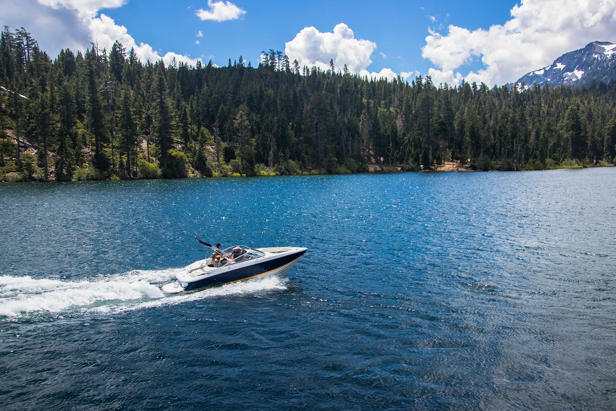
Lake Tahoe is North America’s largest alpine lake – 200 square miles of crystal-clear water straddling California and Nevada, with 72 miles of shoreline to explore. Whether you’re cruising toward Emerald Bay, anchoring at a quiet cove on the north shore, or launching from one of the lake’s many marinas, Lake Genius gives you the underwater terrain, depth data, and curated destinations to make every trip smarter and safer.


Download Lake Genius for Lake Tahoe – Free Trial
Why Lake Tahoe Boaters Use Lake Genius
Lake Tahoe’s size and depth make it one of the most stunning boating destinations in the country – but that same scale means there’s a lot of water to cover. With shoreline spanning two states, dozens of marinas and launch points, and underwater terrain that varies dramatically from the shallow south shore to depths exceeding 1,600 feet, having the right tool on your phone makes a real difference.
See what’s under the surface
Lake Tahoe’s famous clarity lets you see deep into the water, but not everything is visible from the boat. The app’s X-Ray View shows you the underwater terrain and depth contours updated daily, so you know what’s below before you get there.
Find the best spots without the guesswork
Lake Genius maps hundreds of curated points of interest around Lake Tahoe – beaches, coves, marinas, boat ramps, swimming spots, hiking trailheads, and more. Every marker is placed by the Lake Genius team, not crowdsourced.
Plan before you launch
Explore the map from home, mark your stops, estimate distances, and save your route. When you’re ready to hit the water, everything is already on your phone – no scrambling at the dock.
Works even in remote areas
Some stretches of Lake Tahoe’s shoreline have limited cell coverage, especially on the west shore and in areas around Emerald Bay. Download your maps before you go and the app works offline.
See What’s Under Lake Tahoe’s Surface
Lake Tahoe is the deepest lake in the United States after Crater Lake, with a maximum depth of over 1,600 feet. But depth varies enormously – near shore, around rock formations, and in popular coves, the bottom can be much closer to the surface than you’d expect.
The X-Ray View is Lake Genius’s signature feature. As you zoom in on the map, a simulated 3D visualization reveals the terrain beneath the water. Underwater elevation contours appear with the current water line highlighted in red, so you always know where the actual shoreline sits today. The X-Ray View updates daily, giving you a current picture of what’s below – not a static snapshot from months ago.
This matters at Lake Tahoe because the underwater landscape near popular destinations like Emerald Bay, Sand Harbor, and the east shore coves includes rock formations and shallow ledges that aren’t always obvious from the surface. The X-Ray View helps you spot those areas before you’re on top of them.
TODAY’S WATER LEVEL
Lake Tahoe Water Level – Updated Daily
Lake Tahoe’s water level moves with the seasons. Snowmelt and spring runoff push levels up, while dry summers and controlled outflow at the Tahoe City Dam bring them back down. These changes may not be as dramatic as some western reservoirs, but they still affect what’s near the surface – and that’s what matters when you’re on the water.
Lake Genius tracks the current water level at Lake Tahoe and updates it daily. The app displays the level in feet or meters based on your preference, and the red shoreline on the map adjusts to reflect today’s conditions. Everything underwater moves in relation to the water level, so a daily update means the depth data you’re looking at is current – not from last season.
Pro tip: Check the latest water level before you leave Wi-Fi or cellular coverage. The app will use the most recent data you’ve loaded, so you’re covered for the day.
MARINAS & LAUNCH RAMPS
Lake Tahoe Marinas & Boat Launches
Lake Tahoe has marinas and boat launch ramps on both the California and Nevada sides, giving boaters multiple access points no matter where they’re staying. Lake Genius maps them all – with locations, services, and surrounding points of interest right on the map.
Tahoe Keys Marina
The largest marina on Lake Tahoe, located in South Lake Tahoe. Tahoe Keys offers boat slips, fuel, rentals, and direct access to the main body of the lake. It’s the departure point for many charter and tour boats.
Zephyr Cove Marina
On the Nevada side of South Lake Tahoe, Zephyr Cove is home to the M.S. Dixie II paddlewheeler and is a popular launch point for cruises to Emerald Bay. The marina offers boat rentals, jet ski rentals, and parasailing.
Timber Cove Marina
A full-service marina in South Lake Tahoe offering boat rentals, moorings, and fuel. Timber Cove is conveniently located near downtown shops and dining.
Camp Richardson Marina
Located on the south shore near the entrance to Emerald Bay, Camp Richardson is a historic lakeside resort with a marina offering boat rentals, kayak rentals, and beach access. It’s one of the closest launch points to Emerald Bay.
Cave Rock Boat Launch
A public boat launch on the east shore, Cave Rock offers a double ramp and trailer parking. It’s a popular option for boaters bringing their own vessel, with easy access to the open water and the east shore’s scenic rock formations.
Lakeside Marina
Located near the Stateline casinos in South Lake Tahoe, Lakeside Marina offers slip rentals, moorings, a boat launch, fuel dock, and boat storage. It’s a convenient option for boaters staying in the Stateline area.
Obexer’s Boat Company
A west shore institution in Homewood, Obexer’s offers boat rentals, slip rentals, storage, and a boat launch. It provides direct access to the quieter west shore and is one of the closest marinas to some of Tahoe’s most scenic stretches.
Explore Lake Tahoe
Lake Tahoe isn’t just one destination – it’s dozens. From the turquoise waters of Emerald Bay to the rock formations at Sand Harbor, from quiet west shore coves to the bustling south shore beaches, there’s more to explore than most visitors realize. Lake Genius maps hundreds of curated points of interest around Lake Tahoe, so you can find the spots that match your day.
- Emerald Bay. Often called the crown jewel of Lake Tahoe, Emerald Bay features the lake’s only island (Fannette Island), Vikingsholm Castle, and some of the most photographed views in the Sierra. The app maps access points, anchoring zones, and nearby trailheads so you can plan your approach from the water.
- Beaches & swimming spots. Pope Beach, Sand Harbor, Baldwin Beach, Lakeside Beach, and dozens of smaller coves offer everything from family-friendly shallow water to secluded anchoring spots. Lake Genius shows you where they are and what’s nearby.
- Hiking trailheads. The Tahoe Rim Trail circles the entire lake basin across 165 miles, and shorter hikes like Eagle Falls and Mount Tallac are accessible from the water. The app marks trailheads and parking areas so you can boat to a hike.
- Scenic viewpoints & historic sites. From the Heavenly Gondola’s 9,136-foot observation deck to the Tallac Historic Site’s restored 1920s estates, Lake Tahoe blends natural beauty with cultural landmarks. Lake Genius helps you find them all.
Plan Your Lake Tahoe Trip Before You Leave Home
Lake Tahoe is 72 miles of shoreline across two states – that’s a lot of water to cover in a weekend. Whether you’re renting a boat for the day or launching your own, planning your route ahead of time means you actually get to the spots you came for instead of spending half the day figuring out where to go.
Lake Genius lets you explore the full map from home. Mark the beaches, coves, and marinas you want to visit. Estimate distances and travel times between stops. Save your route and it’s waiting on your phone when you get to the lake. During the trip, the app tracks your GPS route so you can retrace your path next time.
Found a hidden cove or the perfect anchoring spot? Save it as a custom marker with the Photo Marker feature – snap a photo and the app pins it to the map. Share your markers with friends and family via text message so they can find the same spot.
Lake Tahoe Weather – One Tap, Current Conditions
Mountain weather moves fast. Lake Tahoe sits at over 6,200 feet of elevation, and conditions can shift from calm morning water to whitecap-producing afternoon winds in a few hours. Knowing what’s coming before you head out – or while you’re already on the water – helps you plan your day around conditions rather than reacting to them.
Lake Genius gives you one-tap access to current weather data for Lake Tahoe. Tap your current location or any point on the map, and the app pulls up the NOAA weather page for that area – conditions, wind speed, temperature, and precipitation. It’s the fastest way to check what’s happening at the lake right now.
Download Your Maps – Works Offline at the Lake
Most of Lake Tahoe has decent cell coverage, but there are stretches – especially along the west shore and in certain coves – where signal drops out. And when you’re in the middle of the lake, you don’t want to depend on a cell tower to see your map.
Download the Lake Tahoe map to your phone before your trip and the full app works without an internet connection. Depth data, POI markers, your saved routes, and custom markers are all available offline. Water level updates and weather notices require a connection when you access them, but the best practice is simple: check the latest level and weather before you leave Wi-Fi, and you’re set for the day.
TESTIMONIALS
What Lake Tahoe Boaters Are Saying
TESTIMONIAL PLACEHOLDER #1
A testimonial about the overall app experience — ideally from a boater who used multiple features on a single trip. Example: someone who planned from home, used the X-Ray View on the water, and found a hidden cove via POI. Should convey “this app changed how I experience the lake.”
— John
- Bear Lake
TESTIMONIAL PLACEHOLDER #1
A testimonial focused on hazard avoidance or money saved — someone who spotted a hazard before it became a problem. Connects to the X-Ray View and water levels features. Should convey “this paid for itself immediately.”
— Steve
- Bear Lake
TESTIMONIAL PLACEHOLDER #1
A testimonial about offline reliability or trip planning from home — especially relevant for families or houseboat renters. Should convey “I was confident even in areas with no cell service” or “we planned the whole trip before we left.”
— Gabrielle
- Lake Powell
Frequently Asked Questions
What app should I use for boating on Lake Tahoe?
What app should I use for boating on Lake Tahoe?
Lake Genius is a boating app designed for Lake Tahoe and other popular western lakes. It includes daily underwater terrain updates, hundreds of curated points of interest, offline maps, trip planning, and GPS route tracking – all for one annual subscription that covers every lake in the app.
Does Lake Genius work offline at Lake Tahoe?
Does Lake Genius work offline at Lake Tahoe?
Yes. Download the Lake Tahoe map before your trip and the app’s core features – depth data, POI markers, saved routes, and custom markers – all work without an internet connection. Water level updates and weather require a connection when accessed.
How deep is Lake Tahoe?
How deep is Lake Tahoe?
Lake Tahoe’s maximum depth is approximately 1,645 feet, making it the second-deepest lake in the United States. Depth varies significantly around the shoreline and in coves. Lake Genius displays underwater depth contours so you can see what’s beneath the surface at any point on the map.
What marinas does Lake Genius cover at Lake Tahoe?
What marinas does Lake Genius cover at Lake Tahoe?
Lake Genius maps marinas and boat launches around Lake Tahoe on both the California and Nevada sides, including major marinas like Tahoe Keys, Zephyr Cove, Timber Cove, Camp Richardson, Cave Rock, Lakeside, and Obexer’s. Each marker shows location and surrounding points of interest.
Can I check Lake Tahoe’s water level in the app?
Can I check Lake Tahoe’s water level in the app?
Yes. Lake Genius displays the current Lake Tahoe water level, updated daily, in feet or meters. The red shoreline on the map adjusts to reflect today’s level, and the X-Ray View uses the daily data to show you what’s near the surface right now.
Is Lake Tahoe in California or Nevada?
Is Lake Tahoe in California or Nevada?
Lake Tahoe straddles both states – roughly two-thirds of the lake is in California and one-third is in Nevada. Lake Genius covers the full lake regardless of which side you’re boating on, with marinas, POI, and depth data across both states.
What is there to do at Lake Tahoe in summer?
What is there to do at Lake Tahoe in summer?
Lake Tahoe is a premier summer destination for boating, kayaking, paddleboarding, swimming, fishing, and hiking. Lake Genius maps hundreds of summer destinations including beaches, coves, marinas, trailheads, and scenic viewpoints – all accessible from the app’s interactive map.
Does Lake Genius show Emerald Bay on the map?
Does Lake Genius show Emerald Bay on the map?
Yes. Emerald Bay and its surrounding points of interest – including Fannette Island, Vikingsholm Castle, and Eagle Falls trailhead – are mapped in the app. The X-Ray View also shows the underwater terrain within Emerald Bay so you can navigate the area confidently.
See It in Action – Download Lake Genius for Lake Tahoe
Daily underwater terrain updates. Hundreds of curated destinations. Offline maps for the entire lake. Trip planning from home. All in one app, for one annual subscription.
Start your free trial · No credit card · Works offline · $19.99/year