
Best Boating App for Lakes – Why Boaters Choose Lake Genius
If you’re looking for a boating app that actually understands lakes – not oceans, not shipping channels, not coastline charts – you’re in the right place. Lake Genius is built specifically for lake boaters who want to see underwater hazards, track water levels, and navigate with confidence.
See Why Boaters Switch – Download Free


What Makes a Great Lake Boating App?
Not all boating apps are created equal – especially when you’re on a lake. Most popular marine chart apps were designed for saltwater, coastal navigation, and offshore fishing. They’re packed with features you’ll never use on a reservoir, and they’re missing the one thing you actually need: daily underwater hazard detection.
A great lake boating app should do a few things really well:
Show you what’s under the water – today, not last season
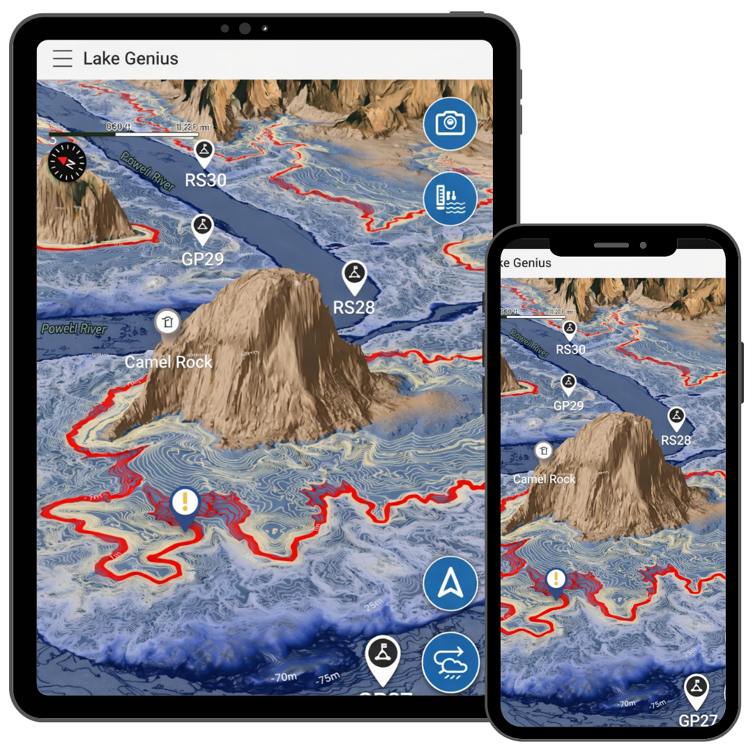
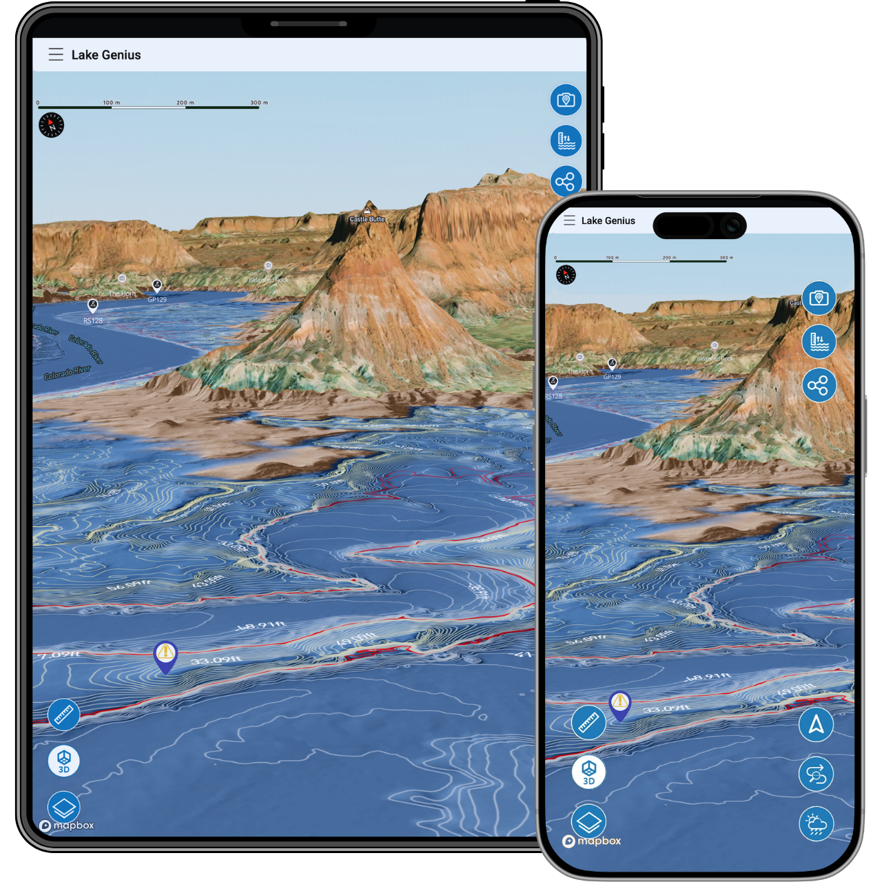
Water levels on reservoirs change constantly, and yesterday’s safe channel can be today’s prop-killer. You need an app that updates hazards daily, not one that ships static contour maps once a year.
Work where you actually boat
If your app loses all its useful features the moment you leave cell coverage, it’s not much help at the lake. Offline capability isn’t a nice-to-have – it’s essential.
Know these lakes specifically
Generic worldwide apps spread their coverage thin. A lake-focused app can go deep on the details that matter: curated points of interest, lake-specific hazard data, and features built around how people actually use these lakes.
Paper Maps vs. Generic Apps vs. Lake Genius
There are a few ways boaters typically try to navigate the lakes we cover. Here’s how they stack up.
Feature
Daily underwater hazard updates
Daily water levels
Lake-specific POI (curated)
Offline maps
Trip planning from home
Route saving & sharing
Built for these specific lakes
Weather info (NOAA)
Lake Genius
- Yes
- Yes
- 2,000+
- Full offline
- Yes
- Unlimited
- Yes
- One-Tap
Paper Maps
- No
- No
- Limited
- Physical
- No
- No
- Yes
- No
Road Nav Apps
- No
- No
- No
- Limited
- No
- No
- No
- No
Generic Boating Apps
- Static data
- Varies
- Crowdsourced
- Varies
- Basic
- Limited
- Worldwide / generic
- Varies
Paper maps are familiar, but they’re static – no hazard data, no digital search, no way to plan a route before you leave home. Road navigation apps like Google Maps are built for highways, not waterways. And generic boating apps? They cover the entire world, which means they don’t go deep on any single lake. Their data is often static, crowdsourced, and updated far less frequently than daily.
Difference
Daily Updates – Not Static Data
Here’s the thing about reservoirs: they change. Water levels rise and fall with seasons, snowmelt, and water management decisions. When levels drop, underwater hazards that were safely submerged last month are suddenly right below the surface. When levels rise, familiar shorelines shift and new areas open up.
Most boating apps ship with static contour maps that get updated once a year – maybe. Lake Genius updates every day. Our X-Ray View processes the latest water level data and shows you exactly which underwater terrain is within striking distance of your hull and propeller. That’s the difference between navigating with confidence and hoping for the best.
Built for These Lakes, Not the Entire Ocean
Lake Genius doesn’t try to cover every body of water on Earth. We focus on the lakes where we have deep, firsthand expertise – and we’re expanding into new lakes regularly. That focus means better data, more relevant points of interest, and features designed around how lake boaters actually spend their time on the water.
Our team has spent years boating these lakes. We’ve visited the boat shops, talked to the marina operators, and personally dealt with the prop damage that comes from navigating without good data. That local knowledge shows up in every part of the app – from the 2,000+ curated points of interest to the way we prioritize hazard zones that catch boaters off guard.
Popular marine chart apps cast a wide net. They cover oceans, coastlines, rivers, and lakes all in one product. That breadth comes at a cost: less depth on any single lake, fewer curated POI, and data that’s often sourced from crowdsourced contributions rather than expert curation.
Our Value
What Your Subscription Is Actually Worth
Let’s talk about what a single underwater hazard strike actually costs. Boat shops across the region routinely see repair bills between $5,000 and $10,000 from propeller and hull damage caused by submerged rocks. We’ve documented one case where a drive system and hull repair totaled $20,000. Destroyed propellers are so common at some lakes that boat rental operators keep a box of them on display.
Lake Genius gives you daily underwater hazard detection, water level tracking, 2,000+ curated points of interest, trip planning tools, offline maps, and more – all for $19.99 a year. That’s a fraction of the cost of a single tank of gas for most boats, and it could save you thousands in damage you didn’t see coming.
Every feature is available during the free trial – no credit card required. You can see the X-Ray View, explore points of interest, plan a route, and download offline maps before you decide.
TESTIMONIALS
What Real Boaters Say
We’re building a community of boaters who navigate smarter. Here’s what they’re saying.
We’ve taken several family houseboat trips to the lake in years past. We normally relied on maps.
I was happy to find an affordable electronic option when I learned of Lake Genius, so downloaded it and subscribed prior to our trip in mid-October 2025. Looking at the app at home I was impressed with the amount of detail concerning elevations and landmarks. In use on the lake, I had a hard time finding a zoom level that would show me both buoy locations and enough elevation / depth information to be useful while underway, but recent updates have fixed that. We found the app very useful overall and a great value.
— DonJ60
- Bear Lake
Rarely do I leave reviews on apps, but this is an absolute must have in Lake Powell!!
Thank you for an awesome app to help with boating —especially with Lake Powell newbies like us. Heck, even my long time Lake Powell buddies thought this was amazing.
— Mxracer317
- Bear Lake
This app is awesome!
Such a great way to spot underwater hazards easily on your phone. Saves you a lot of hassle and money from hitting your prop on a rock!
— Liv.ballam
- Lake Powell
6,000+ downloads. 1 in 4 boaters who try it, subscribe. Trusted by marina operators who recommend Lake Genius to their customers.
Frequently Asked Questions
What is the best boating app for lakes?
What is the best boating app for lakes?
Lake Genius is purpose-built for lake boaters. Unlike generic marine chart apps designed for oceans and coastlines, Lake Genius focuses on the features lake boaters actually need: daily underwater hazard detection, water level tracking, 2,000+ curated points of interest, trip planning, and offline maps that work where cell service doesn’t.
How does Lake Genius compare to other boating apps?
How does Lake Genius compare to other boating apps?
Most boating apps use static data and cover the entire world. Lake Genius updates underwater hazard data daily and focuses specifically on the lakes we cover. Our points of interest are curated by local experts – not crowdsourced. And every core feature works offline, which is essential at lakes with limited cell coverage.
Is there a good alternative to popular marine chart apps for lake boating?
Is there a good alternative to popular marine chart apps for lake boating?
If you’re looking for an alternative that’s designed for lakes rather than ocean navigation, Lake Genius is built for exactly that. We focus on daily underwater hazard updates, lake-specific POI, and offline functionality – features that matter most on reservoirs and lakes where conditions change daily.
Do boating apps work on lakes?
Do boating apps work on lakes?
Many general boating apps technically work on lakes, but they’re not optimized for them. They often lack lake-specific features like daily underwater hazard updates, reservoir water level tracking, and curated points of interest for lake activities. Lake Genius is built specifically for the lakes we cover.
Can I try Lake Genius before subscribing?
Can I try Lake Genius before subscribing?
Yes. Lake Genius offers a free trial with full access to every feature – no credit card required. You can explore the X-Ray View, check water levels, browse points of interest, and plan routes during the trial.
Does Lake Genius work without cell service?
Does Lake Genius work without cell service?
Yes. Download your maps before you leave home and every core feature works offline – including underwater hazard detection, navigation, points of interest, and route tracking. Water level updates and weather info require an internet connection when accessed.
Try It Free – See It in Action
Every feature is included in the free trial. No credit card, no commitment. Download Lake Genius, explore the map, check underwater hazards, browse 2,000+ points of interest, and plan your next trip – all before you get to the lake.
5,000+ downloads · Trusted by marina operators · Updated daily